Category:Maps of Iquitos
Jump to navigation
Jump to search
Wikimedia category | |||||
| Upload media | |||||
| Instance of | |||||
|---|---|---|---|---|---|
| Category combines topics | |||||
| Iquitos | |||||
city of Peru, capital of Loreto region | |||||
| Instance of | |||||
| Location | Maynas Province, Loreto Department, Peru | ||||
| Located in or next to body of water | |||||
| Inception |
| ||||
| Population |
| ||||
| Area |
| ||||
| Elevation above sea level |
| ||||
 | |||||
Media in category "Maps of Iquitos"
The following 20 files are in this category, out of 20 total.
-
Location of the city of Iquitos in Peru.png 215 × 311; 16 KB
-
Ubicacion de Iquitos en el Perú.PNG 215 × 311; 16 KB
-
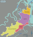
Barrio de Belen.png 541 × 600; 69 KB
-
Capitania de Maynas.png 550 × 600; 67 KB
-
Centro histórico de Iquitos.jpg 1,789 × 1,210; 257 KB
-
Croquis General de Iquitos - Convertido.png 2,000 × 2,497; 1.58 MB
-
Croquis General de Iquitos.svg 620 × 774; 1.19 MB
-
Distrito de Iquitos en Iquitos.png 5,000 × 2,322; 936 KB
-
Distritos de Iquitos.png 1,024 × 476; 171 KB
-
Incendio de Iquitos de 2017.png 1,480 × 1,888; 123 KB
-
Iquitos Mapa de distritos 01.png 5,552 × 6,142; 1.96 MB
-
Iquitos Mapa de distritos 02.svg 1,665 × 1,843; 94 KB
-
Iquitos Mapa de distritos 03.svg 1,665 × 1,843; 152 KB
-
Iquitos-OpenStreetMap.jpg 1,102 × 604; 73 KB
-
Mapa de Maynas señalando Iquitos.svg 6,599 × 5,030; 201 KB
-
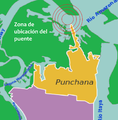
Puente nanay ubicacion.png 3,472 × 3,544; 387 KB
-
The earth and its inhabitants (1894) (14743436356).jpg 1,664 × 1,878; 651 KB
-
Ubicacion Barrio de Bellavista Nanay.png 541 × 600; 26 KB
-
Ubicación del incendio en Iquitos de 2017.png 230 × 266; 99 KB


