Category:Maps of Ipswich
Jump to navigation
Jump to search
Wikimedia category | |||||
| Upload media | |||||
| Instance of | |||||
|---|---|---|---|---|---|
| Category combines topics | |||||
| Ipswich | |||||
county town of Suffolk, England | |||||
| Instance of |
| ||||
| Location |
| ||||
| Located in or next to body of water | |||||
| Population |
| ||||
| Area |
| ||||
| official website | |||||
 | |||||
Subcategories
This category has the following 3 subcategories, out of 3 total.
Media in category "Maps of Ipswich"
The following 29 files are in this category, out of 29 total.
-
CentralSuffolkConstituency.svg 200 × 150; 57 KB
-
CentralSuffolkNorthIpswich2007Constituency.svg 208 × 155; 144 KB
-
Duke Street base.png 923 × 682; 248 KB
-
Duke Street w.svg 923 × 682; 341 KB
-
Duke Street.png 923 × 682; 321 KB
-
Gainsborough Electoral Division, Suffolk.png 567 × 663; 524 KB
-
Grange farm map.png 818 × 548; 354 KB
-
Ipswich bus map.png 948 × 586; 540 KB
-
Ipswich cycle map.png 815 × 556; 879 KB
-
Ipswich map.png 802 × 543; 506 KB
-
Ipswich UK locator map.svg 1,425 × 927; 1,024 KB
-
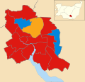
Ipswich UK ward map 2022.svg 1,319 × 1,266; 218 KB
-
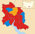
Ipswich UK ward map 2023.svg 1,319 × 1,266; 219 KB
-
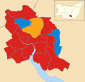
Ipswich UK ward map 2024.svg 1,319 × 1,266; 219 KB
-
Ipswich2006 redlight.png 799 × 467; 115 KB
-
Ipswich2006.svg 799 × 467; 34 KB
-
Ipswich2007Constituency.svg 208 × 155; 144 KB
-
IpswichConstituency.svg 200 × 150; 57 KB
-
Location map United Kingdom Ipswich Central.png 1,885 × 1,337; 1.59 MB
-
Map of site of Handford Mill, Ipswich.png 749 × 462; 203 KB
-
Map St Helens Electoral District, Suffolk.png 414 × 407; 261 KB
-
Ordnance Survey One-Inch Sheet 150 Ipswich, Published 1946.jpg 11,004 × 12,810; 12.76 MB
-
Ordnance Survey One-Inch Sheet 150 Ipswich, Published 1956.jpg 8,321 × 9,932; 8.12 MB
-
Ordnance Survey One-Inch Sheet 150 Ipswich, Published 1969.jpg 8,278 × 9,900; 29.02 MB
-
Ordnance Survey One-Inch Sheet 87 Ipswich, Published 1921.jpg 12,187 × 8,446; 38.8 MB
-
Site of Landseer Park, 1902.jpg 1,034 × 403; 68 KB
-
SuffolkIpswich.png 200 × 147; 12 KB
-
Urban limited-access road.png 981 × 515; 214 KB


