Category:Maps of India in the Wellcome Collection
Jump to navigation
Jump to search
Media in category "Maps of India in the Wellcome Collection"
The following 13 files are in this category, out of 13 total.
-
A map of India, showing Malabar, Madura and Cormeddel Wellcome L0038175.jpg 3,888 × 3,120; 3.34 MB
-
India; Map; 1929 Wellcome L0024831.jpg 1,482 × 1,322; 1.15 MB
-
Malarial map of India Wellcome L0069771.jpg 5,300 × 4,343; 4.48 MB
-
Map of India, showing the chinchona plantations Wellcome L0025460.jpg 1,282 × 1,437; 717 KB
-
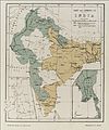
Map of the Indian Empire. Wellcome M0001254.jpg 1,519 × 1,264; 746 KB
-
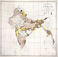
Map showing the distribution of Leprosy in India Wellcome L0039112.jpg 4,200 × 4,208; 11.9 MB
-
Map showing the distribution of Leprosy in India Wellcome L0039113.jpg 4,200 × 4,169; 11.75 MB
-
Map showing the distribution of Leprosy in India Wellcome L0039114.jpg 4,220 × 4,157; 13.09 MB
-
Map showing the distribution of Leprosy in India Wellcome L0039115.jpg 4,200 × 4,206; 10.6 MB
-
Map showing the route of cholera infection through Asia Wellcome L0074533.jpg 5,084 × 3,316; 4.45 MB
-
Salt and Leprosy - II. Wellcome L0038519.jpg 3,366 × 4,056; 3.06 MB
-
Sir Patrick Hehir, Malaria in India Wellcome L0026242.jpg 1,554 × 1,344; 764 KB
-
Weather chart of India Wellcome L0038517.jpg 3,924 × 3,978; 4.87 MB


