Category:Maps of India in the 7th century
Jump to navigation
Jump to search
This category is about the subject of the Indian subcontinent 601-700 CE: History maps showing India as it was in the 7th century.
Contemporary old maps belong into: Category:Old maps of India and its subcategories.
Maps of the history of India: (BCE) 6th century · 5th century · 4th century · 3rd century · 2nd century · 1st century · (CE) 1st century · 2nd century · 3rd century · 4th century · 5th century · 6th century · 7th century · 8th century · 9th century · 10th century · 11th century · 12th century · 13th century · 14th century · 15th century · 16th century · 17th century · 18th century · 19th century · 20th century ·
Media in category "Maps of India in the 7th century"
The following 12 files are in this category, out of 12 total.
-
The Ancient Geography of India - Map I.png 1,389 × 2,210; 1.56 MB
-
Arabsumf.png 1,000 × 1,056; 319 KB
-
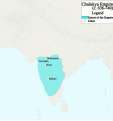
Chalukya Empire Map.svg 1,008 × 1,072; 1,020 KB
-
Harsha2007.jpg 800 × 655; 56 KB
-
India 7th century AD.jpg 1,272 × 1,719; 2.19 MB
-
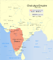
Indian Chalukya Empire map.svg 1,639 × 1,852; 520 KB
-
Kamarupa 7th-8th Century AD.jpg 960 × 720; 485 KB
-
Kamarupa 7th-8th Century Cities.jpg 960 × 720; 493 KB
-
Rai Dynasty of Sindh under Rai Shasi II The Last.png 5,699 × 6,885; 4.37 MB
-
Sindh 700ad-ar.png 720 × 473; 685 KB
-
Sindh 700ad.jpg 720 × 473; 432 KB


