Category:Maps of India and Sri Lanka
Jump to navigation
Jump to search
Subcategories
This category has the following 3 subcategories, out of 3 total.
Media in category "Maps of India and Sri Lanka"
The following 41 files are in this category, out of 41 total.
-
*The Palk Strait and the Gulf of Manaar, from a map by SDUK, 1831*.jpg 1,280 × 888; 196 KB
-
1733 Homann Heirs Map of India - Geographicus - India-homannheirs-1733.jpg 4,000 × 4,527; 5.41 MB
-
1768 'The East Indies, with the Roads.' by Thomas Jefferys, Geographer to the King.jpg 16,966 × 13,070; 36.93 MB
-
1780 Raynal and Bonne Map of Southern India - Geographicus - Indes-bonne-1780.jpg 2,500 × 1,739; 1.08 MB
-
1814 Thomson Map of India w-Ganges - Geographicus - Hindoostan-t-1814.jpg 5,000 × 3,779; 4.41 MB
-
60The South Indian Railway.jpg 1,689 × 1,897; 985 KB
-
Calotes ellioti distribution.png 1,259 × 944; 986 KB
-
Coromandel, *From James Wyld's "Atlas of the World," 1853*.jpg 480 × 640; 153 KB
-
Cotes-Inde du Sud.png 602 × 644; 20 KB
-
Distribution of Simotes arnensis (1886).jpg 1,806 × 1,366; 353 KB
-
From a map by J. H. Coulton, published in Coulton's Atlas of the World, 1856.jpg 960 × 1,280; 291 KB
-
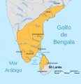
ImperioPandya1251-1283AD.svg 831 × 857; 592 KB
-
India in 1893, geological features.jpg 2,340 × 2,958; 6.06 MB
-
India map 1500.jpg 1,470 × 1,977; 1.61 MB
-
India Sri Lanka Locator.png 689 × 519; 59 KB
-
India, distribution of languages, 1893.jpg 955 × 1,285; 216 KB
-
India-Sri Lanka maritime boundary.svg 800 × 600; 61 KB
-
Indian Brown Mongoose area.png 170 × 190; 3 KB
-
Karikala territories.png 429 × 321; 13 KB
-
Malabar trogon map.png 299 × 297; 1 KB
-
Map of india.jpg 2,448 × 3,264; 3.98 MB
-
Map1880s.jpg 1,071 × 1,600; 135 KB
-
Old map of India, from the British Library.jpg 2,034 × 3,021; 1.35 MB
-
Pandya Kingdom (south India).png 1,720 × 1,338; 443 KB
-
Playfair, Principal. Map of the World According to Strabo. 1814 D.jpg 2,333 × 2,096; 634 KB
-
Rama’s route from Lanka back to Ayodhya.jpg 1,957 × 2,824; 883 KB
-
SouthIndia1704SubrahCIA2001.jpg 951 × 549; 104 KB
-
Sphenomorphus dussumieri distribution (IUCN).png 1,259 × 944; 987 KB
-
Sphenomorphus dussumieri distribution (RDB).png 1,259 × 944; 984 KB
-
Sri Lanka 80.19386E 7.93007N.jpg 1,280 × 958; 73 KB
-
Stripe-necked Mongoose area.png 170 × 190; 3 KB
-
Tamil Nadu and Kerala Openstreetmap Atlas.png 11,023 × 12,401; 15.95 MB
-
Tamil Nadu topo deutsch mit Gebirgen.png 592 × 529; 538 KB
-
The Maldiva Islands-Captain Horsburgh-1814.png 714 × 1,040; 764 KB
-
Trimeresurus gramineus distribution.png 1,259 × 944; 1.02 MB


