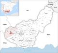
Category:Maps of Huétor Tájar
Jump to navigation
Jump to search
Municipalities of the province of Granada: Alamedilla · Albolote · Alhama de Granada · Almuñécar · Baza · Capileira · Granada · Guadix · Huétor Tájar · Láchar · Lanjarón · Loja · Montefrío · Motril · Órgiva · Salobreña · Trevélez ·
Media in category "Maps of Huétor Tájar"
The following 11 files are in this category, out of 11 total.
-
LocationHuétor-Tájar.png 529 × 435; 24 KB
-
HUETOR LOC NUCLEOS.svg 1,227 × 636; 307 KB
-
Huetor localizacion.jpg 1,158 × 1,636; 1.2 MB
-
Huetor mapa poblacion.png 3,509 × 2,478; 279 KB
-
Huetor tajar fisico.png 3,509 × 2,478; 128 KB
-
Huétor usos.png 3,509 × 2,478; 442 KB
-
Karte Gemeinde Huétor Tájar 2022.png 2,500 × 2,307; 1,005 KB
-
Localizacion el carcamo 300dpi.png 3,506 × 2,481; 355 KB
-
MTN25-1008c3-1985-Huetor-Tajar.jpg 7,677 × 5,512; 6.94 MB
-
MTN25-1008c3-2001-Huetor Tajar.jpg 7,677 × 5,512; 8.81 MB
-
MTN25-1008c3-2010-Huetor Tajar.jpg 7,874 × 5,174; 11.38 MB


