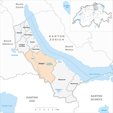
Category:Maps of Horgen
Jump to navigation
Jump to search
Wikimedia category | |||||
| Upload media | |||||
| Instance of | |||||
|---|---|---|---|---|---|
| Category combines topics | |||||
| Horgen | |||||
municipality in the canton of Zurich, Switzerland | |||||
| Instance of |
| ||||
| Part of |
| ||||
| Location |
| ||||
| Located in or next to body of water | |||||
| Visitor center |
| ||||
| Connects with | |||||
| Legislative body | |||||
| Official language | |||||
| Head of government |
| ||||
| Heritage designation | |||||
| Inception |
| ||||
| Significant event | |||||
| Highest point |
| ||||
| Population |
| ||||
| Area |
| ||||
| Elevation above sea level |
| ||||
| Replaces |
| ||||
| Budget |
| ||||
| Different from | |||||
| official website | |||||
 | |||||
Media in category "Maps of Horgen"
The following 17 files are in this category, out of 17 total.
-
A3 Horgen, map OSM 2022.png 714 × 735; 198 KB
-
Dorfbach Schliffitobel Horgen 1887.jpg 1,338 × 718; 282 KB
-
ETH-BIB-Shil-Tal-Karte 1-500'000-Dia 247-Z-00306.tif 2,944 × 3,428; 29.03 MB
-
Gygerkarte Horgen.jpg 3,717 × 2,766; 3.73 MB
-
Heilibach Seegarten Horgen 1887.jpg 1,328 × 688; 255 KB
-
Horgen Heubach Wasserrecht 1898.jpg 3,233 × 2,573; 632 KB
-
Karte Gemeinde Horgen 2007.png 1,476 × 1,478; 537 KB
-
Karte Gemeinde Horgen.png 767 × 801; 148 KB
-
Karte Horgen 1855.jpg 11,118 × 7,045; 18.82 MB
-
Karte Käpfnach 1899.jpg 9,433 × 4,869; 10.26 MB
-
Karte Sihl.png 1,476 × 1,724; 457 KB
-
Seegarten Horgen 1897.jpg 1,319 × 702; 271 KB
-
Seegarten Horgen 1907.jpg 1,322 × 706; 290 KB
-
Sihlwald Siegfried 1880.jpg 706 × 713; 205 KB
-
Stadt Horgen 2021.png 3,985 × 4,161; 6.29 MB
-
Säge Sihlwald Siegfried 1930.jpg 742 × 678; 219 KB
-
Übersichtsplan Gemeinde Horgen 1891.jpg 11,881 × 8,896; 31.03 MB


