Category:Maps of Hocking County, Ohio
Jump to navigation
Jump to search
Wikimedia category | |||||
| Upload media | |||||
| Instance of | |||||
|---|---|---|---|---|---|
| Category combines topics | |||||
| Hocking County | |||||
county in Ohio, United States | |||||
| Instance of | |||||
| Named after | |||||
| Location | Ohio | ||||
| Capital | |||||
| Headquarters location | |||||
| Inception |
| ||||
| Population |
| ||||
| Area |
| ||||
| official website | |||||
 | |||||
Hocking County is in Ohio in the United States. Its county seat is Logan.
Subcategories
This category has the following 3 subcategories, out of 3 total.
Media in category "Maps of Hocking County, Ohio"
The following 25 files are in this category, out of 25 total.
-
A plat of Good Hope township, Hocking County, Ohio (4231922320).jpg 1,260 × 2,000; 2.06 MB
-
A plat of Green township, Hocking County, Ohio (4231922214).jpg 2,000 × 1,697; 2.63 MB
-
A plat of Starr township Hocking County Ohio (4231922946).jpg 2,000 × 1,916; 2.85 MB
-
A plat of Ward township, Hocking County Ohio (4231154403).jpg 2,000 × 1,477; 1.91 MB
-
A plat of Washington Township, Hocking County Ohio (4231922716).jpg 2,000 × 1,833; 3.18 MB
-
A plat showing the position of the different townships (4231922420).jpg 2,000 × 1,454; 1.52 MB
-
Bloomingville, (Ohio) (4231153795).jpg 2,000 × 1,495; 2.22 MB
-
Detailed map of Buchtel, Ohio.png 575 × 425; 25 KB
-
Detailed map of Laurelville, Ohio.png 575 × 425; 22 KB
-
Detailed map of Murray City, Ohio.png 575 × 425; 20 KB
-
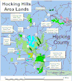
Hocking hills area.gif 1,132 × 1,288; 121 KB
-
Map of Ohio highlighting Hocking County.svg 1,050 × 1,141; 37 KB
-
OHMap-doton-Buchtel.png 274 × 300; 10 KB
-
OHMap-doton-Carbon Hill.png 309 × 352; 17 KB
-
OHMap-doton-Haydenville.png 309 × 352; 17 KB
-
OHMap-doton-Laurelville.png 274 × 300; 10 KB
-
OHMap-doton-Logan.png 274 × 300; 10 KB
-
OHMap-doton-Murray City.png 274 × 300; 10 KB
-
OHMap-doton-Rockbridge.png 309 × 352; 17 KB
-
OHMap-doton-South Bloomingville.png 309 × 352; 17 KB
-
OHMap-doton-Union Furnace.png 309 × 352; 17 KB
-
Plan of Benton township, Hocking County, Ohio (4231293095).jpg 2,000 × 1,869; 3.32 MB
-
The Gore, part of Falls township, north of Green township (4231293235).jpg 2,000 × 835; 1.3 MB
-
Trimble community forest.gif 1,124 × 774; 56 KB
-
Waterloo wildlife locator.gif 495 × 729; 33 KB


