Category:Maps of Heerlen
Jump to navigation
Jump to search
Wikimedia category | |||||
| Upload media | |||||
| Instance of | |||||
|---|---|---|---|---|---|
| Category combines topics | |||||
| Heerlen | |||||
municipality in the Netherlands | |||||
| Pronunciation audio | |||||
| Instance of |
| ||||
| Location | Limburg, Netherlands | ||||
| Capital | |||||
| Head of government |
| ||||
| Population |
| ||||
| Area |
| ||||
| Elevation above sea level |
| ||||
| official website | |||||
 | |||||
Subcategories
This category has only the following subcategory.
Media in category "Maps of Heerlen"
The following 26 files are in this category, out of 26 total.
-
Map - NL - Municipality code 0917 (2009).svg 300 × 160; 531 KB
-
2013-Heerlen.jpg 1,902 × 2,377; 2.86 MB
-
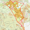
BAG woonplaatsen - Gemeente Heerlen.png 2,419 × 2,419; 924 KB
-
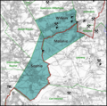
Concessie Willem-Sophia.png 1,122 × 1,117; 1.54 MB
-
Concessies Oranje-Nassaumijnen.png 1,175 × 1,507; 2.68 MB
-
Concessies Particuliere mijnen.png 2,095 × 2,091; 703 KB
-
De hoeve Soureth op de kadastrale minuut van 1822.jpg 1,445 × 1,086; 212 KB
-
Gem-Heerlen-2014Q1.jpg 3,543 × 4,684; 11.51 MB
-
Gem-Heerlen-OpenTopo.jpg 4,308 × 5,824; 4.97 MB
-
Heerlen-1866.jpg 2,231 × 2,854; 1.02 MB
-
Heerlen-plaats-OpenTopo.jpg 2,613 × 3,015; 4.95 MB
-
Heerlen-stad-2014Q1.jpg 2,613 × 2,895; 4.4 MB
-
Heerlen-topografie.jpg 2,333 × 2,737; 4.62 MB
-
HeerlenMIN11037VK1.jpg 9,073 × 5,825; 10.48 MB
-
Heerlerheidezilverzand.png 2,850 × 2,650; 3.88 MB
-
Kadastrale minuut Heerlen, sectie B, blad 4, Robroek.jpg 7,772 × 12,208; 9.14 MB
-
Kadastrale minuut Heerlen, sectie E, blad 4, Welten (Huis Strijthagen).jpg 2,611 × 2,515; 1.47 MB
-
Kadastrale minuut Heerlen, sectie E, blad 4, Welten.jpg 11,826 × 8,148; 7.52 MB
-
Kadastrale minuut Heerlen, sectie F, blad 4, Vrusschenbroek.jpg 12,114 × 7,584; 8.38 MB
-
Kasteel Rodenbroek.jpg 1,207 × 865; 160 KB
-
Map - NL - Grootstedelijke Agglomeratie Heerlen.svg 172 × 140; 484 KB
-
Map - NL - Heerlen (2009).svg 625 × 575; 1.73 MB
-
Map - NL - Oostelijke Mijnstreek.svg 172 × 140; 484 KB
-
NL - locator map municipality code GM0917 (2016).png 2,125 × 1,417; 198 KB
-
Ten Esschen10.JPG 1,600 × 1,200; 363 KB
-
Ten Esschen7.JPG 644 × 656; 78 KB


