Category:Maps of Hamburg-Rotherbaum
Jump to navigation
Jump to search
Wikimedia category | |||||
| Upload media | |||||
| Instance of | |||||
|---|---|---|---|---|---|
| Category combines topics | |||||
| Rotherbaum | |||||
quarter of Eimsbüttel, a borough of Hamburg, Germany | |||||
| Instance of | |||||
| Location | Eimsbüttel, Hamburg, Germany | ||||
| Area |
| ||||
| Elevation above sea level |
| ||||
 | |||||
Media in category "Maps of Hamburg-Rotherbaum"
The following 37 files are in this category, out of 37 total.
-
Pincerno - Rotherbaum - 11-2008.PNG 1,267 × 1,333; 49 KB
-
Rotherbaum in HH.svg 1,713 × 1,689; 780 KB
-
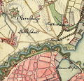
Sternschanze aus varendorf(62)Altona Hamburg Harburg.png 989 × 955; 2.19 MB
-
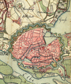
Varendorf(62)Altona Hamburg Harburg.jpg 3,565 × 3,602; 15.77 MB
-
Wallanlagen varendorf(62)Altona Hamburg Harburg.png 1,505 × 1,777; 6.2 MB
-
Hamburg 1790 Elbinseln Varendorf.jpg 3,785 × 2,836; 9.89 MB
-
Hamburg 1790 große karte varendorf.jpg 7,040 × 3,530; 24.56 MB
-
Karte hamburg 1790 varendorf kl.jpg 2,000 × 1,003; 1.28 MB
-
Karte harvestehude vahrendorf.jpg 565 × 754; 568 KB
-
Hamburg.Karte.1813 neddermeyer 300dpi.jpg 5,808 × 4,614; 7.63 MB
-
Karte-sternschanze-schröderstift.png 1,395 × 1,266; 4.53 MB
-
Hamburg1880Gaedechens.jpeg 8,342 × 6,339; 13.81 MB
-
1890 - Norddeutsche Staaten.jpg 3,170 × 1,825; 5.73 MB
-
Begraebnisplatz 1890..jpg 906 × 589; 694 KB
-
Brockhaus and Efron Encyclopedic Dictionary b84 499-0.jpg 3,350 × 2,806; 2.92 MB
-
Hamburg.Plan.1890 retusche.png 3,000 × 1,622; 2.37 MB
-
Hamburg.Plan.1890.png 3,000 × 1,622; 2.39 MB
-
Hamburg 1898 Meyers 5. Aufl..jpg 3,176 × 2,480; 7.3 MB
-
Meyers b8 s0038a.jpg 3,184 × 2,490; 7.07 MB
-
Hamburg 1905 Meyers 6. Aufl..jpg 3,193 × 2,479; 7.88 MB
-
Map hamburg altona 1910.jpg 2,605 × 1,980; 1.62 MB
-
Aussen-und-binnenalster.png 416 × 642; 288 KB
-
Karte Außen- und Binnenalster.svg 969 × 1,387; 2.52 MB
-
Pincerno - Grindel 1-2009.png 1,267 × 1,333; 48 KB
-
Karte Harvestehuder Weg.png 2,209 × 3,484; 2.49 MB
-
HH-Rotherbaum-quarter.jpg 843 × 746; 389 KB
-
John Fontenay's Testament.png 1,136 × 1,249; 265 KB
-
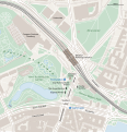
Karte Hamburg-Dammtor.svg 949 × 984; 546 KB
-
Karte Magdalenen-Terrasse.png 1,300 × 1,325; 122 KB
-
Karte Pöseldorf.png 1,577 × 1,777; 904 KB
-
OSM.Hamburg.Feldbrunnenstraße.wmt.png 438 × 928; 272 KB
-
Universität Hamburg - Hauptcampus - Grindelallee.png 699 × 663; 497 KB
-
Hamburg Wahlkreis 5.png 1,186 × 1,144; 28 KB


