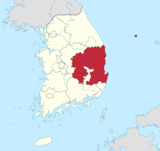
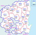
Category:Maps of Gyeongsangbuk-do
Jump to navigation
Jump to search
Wikimedia category | |||||
| Upload media | |||||
| Instance of | |||||
|---|---|---|---|---|---|
| Category combines topics | |||||
| North Gyeongsang | |||||
province in South Korea | |||||
| Instance of | |||||
| Location |
| ||||
| Capital | |||||
| Legislative body |
| ||||
| Executive body |
| ||||
| Population |
| ||||
| Area |
| ||||
| official website | |||||
 | |||||
Subcategories
This category has the following 12 subcategories, out of 12 total.
L
- Maps of Liancourt Rocks (49 F)
M
- Maps of Cheongsong (12 F)
- Maps of Gimcheon (23 F)
- Maps of Gumi (8 F)
- Maps of Gyeongsan (6 F)
- Maps of Pohang (16 F)
- Maps of Uiseong (25 F)
- Maps of Yecheon (6 F)
Media in category "Maps of Gyeongsangbuk-do"
The following 17 files are in this category, out of 17 total.
-
Administrative Map of Uleung Gun.png 600 × 499; 50 KB
-
Diocese of Andong.svg 716 × 1,340; 63 KB
-
Gb box.png 44 × 42; 1 KB
-
Gyeongb-map.png 2,000 × 1,968; 1.54 MB
-
Gyeongsang Basin.jpg 1,674 × 1,848; 2.28 MB
-
Keishō-hoku Prefecture (August 15, 1945).png 2,000 × 2,835; 614 KB
-
Map Gyeongsangbuk-do.jpg 300 × 224; 16 KB
-
Map Gyeongsangbuk-do.png 800 × 708; 86 KB
-
Map Gyeosangbuk-do ja.png 300 × 246; 7 KB
-
Map Gyeosangbuk-do.svg 600 × 492; 57 KB
-
Map of electoral districts of North Gyeongsang Provincial Council (no inset).svg 1,052 × 744; 123 KB
-
Map of electoral districts of North Gyeongsang Provincial Council.svg 1,052 × 744; 149 KB
-
North Gyeongsang map.png 189 × 257; 3 KB
-
The administration map of Gyeongsangbuk Province.jpg 395 × 303; 26 KB
-
Uljin-map.png 1,000 × 1,573; 280 KB
-
Yecheon Map.svg 744 × 1,052; 67 KB
-
Youngduk-map.png 1,000 × 1,661; 393 KB


