Category:Maps of Grenoble
Jump to navigation
Jump to search
Wikimedia category | |||||
| Upload media | |||||
| Instance of | |||||
|---|---|---|---|---|---|
| Category combines topics | |||||
| Grenoble | |||||
commune in Isère, France | |||||
| Instance of | |||||
| Location |
| ||||
| Located in or next to body of water | |||||
| Head of government |
| ||||
| Population |
| ||||
| Area |
| ||||
| Elevation above sea level |
| ||||
| official website | |||||
 | |||||
Use the appropriate category for maps showing all or a large part of Grenoble. See subcategories for smaller areas:
| If the map shows | Category to use |
|---|---|
| Grenoble on a recently created map | Category:Maps of Grenoble or its subcategories |
| Grenoble on a map created more than 70 years ago | Category:Old maps of Grenoble or its subcategories |
| the history of Grenoble on a recently created map | Category:Maps of the history of Grenoble or its subcategories |
| the history of Grenoble on a map created more than 70 years ago | Category:Old maps of the history of Grenoble or its subcategories |
Subcategories
This category has the following 11 subcategories, out of 11 total.
Media in category "Maps of Grenoble"
The following 24 files are in this category, out of 24 total.
-
38 ISERE carte grille communale densite INSEE.png 3,507 × 2,480; 3.61 MB
-
38185-Grenoble-Cadastre.png 7,015 × 4,960; 23.94 MB
-
38185-Grenoble-Hydro.jpeg 5,846 × 4,133; 4.25 MB
-
38185-Grenoble-Hydro.png 7,015 × 4,960; 20.14 MB
-
38185-Grenoble-Sols.png 3,270 × 2,598; 8.1 MB
-
73 SAVOIE carte grille communale densite INSEE.png 3,507 × 2,480; 2.19 MB
-
Aigle Grenoble.png 270 × 270; 57 KB
-
Arrondissement de Grenoble.PNG 503 × 482; 19 KB
-
Carte Isère catastrophe 1219.png 572 × 581; 126 KB
-
Comuni limitrofi Grenoble.tiff 337 × 314; 125 KB
-
Drac Grenoble avant canalisation.jpg 483 × 603; 92 KB
-
Grenoble Alpes Metropole 2014.svg 827 × 1,181; 23 KB
-
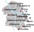
Grenoble et ses communes limitrophes.jpg 212 × 213; 8 KB
-
Grenoble Métropole.jpg 420 × 600; 37 KB
-
Grenoble polygone scientifique map.svg 1,075 × 568; 1.79 MB
-
Grenoble-Mermoz aout1966.png 666 × 1,041; 573 KB
-
Map commune FR insee code 38185.png 756 × 605; 123 KB
-
Noms des communes composant la Métropole de Grenoble.png 744 × 1,052; 101 KB
-
Plan site bastille - Grenoble.jpg 1,200 × 761; 161 KB
-
Projet conservatoire - Grenoble.JPG 1,726 × 527; 161 KB
-
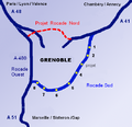
Rocade Sud à Grenoble.png 532 × 514; 192 KB
-
Schéma parc Paul-Mistral -- Grenoble.jpg 1,451 × 720; 77 KB
-
Schéma église Saint-Laurent - Grenoble.JPG 1,998 × 2,241; 443 KB
-
Université Grenoble-Alpes map.svg 561 × 483; 4.39 MB


