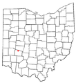
Category:Maps of Greene County, Ohio
Jump to navigation
Jump to search
Wikimedia category | |||||
| Upload media | |||||
| Instance of | |||||
|---|---|---|---|---|---|
| Category combines topics | |||||
| Greene County | |||||
county in Ohio, United States | |||||
| Instance of | |||||
| Named after | |||||
| Location | Ohio | ||||
| Capital | |||||
| Headquarters location | |||||
| Inception |
| ||||
| Population |
| ||||
| Area |
| ||||
| Different from | |||||
| official website | |||||
 | |||||
Greene County is in Ohio in the United States. Its county seat is Xenia.
Subcategories
This category has the following 5 subcategories, out of 5 total.
Media in category "Maps of Greene County, Ohio"
The following 23 files are in this category, out of 23 total.
-
US National Perk Service marker for Huffman Prairie Flying Field.jpg 5,312 × 2,988; 3.46 MB
-
US National Park Service marker for Wright-Patterson Air Force Base.jpg 5,312 × 2,988; 3.79 MB
-
Detailed map of Clifton, Ohio.png 575 × 425; 16 KB
-
Greene County Ohio Xenia highlighted.png 1,100 × 550; 42 KB
-
Map of Greene County, Ohio (14775487729).jpg 2,000 × 1,439; 3.1 MB
-
Map of Greene County, Ohio LOC 2012591127.tif 15,732 × 11,138; 501.32 MB
-
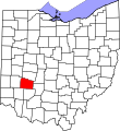
Map of Ohio highlighting Greene County.svg 1,050 × 1,141; 37 KB
-
OHMap-doton-Alpha.png 309 × 352; 17 KB
-
OHMap-doton-Beavercreek.png 274 × 300; 10 KB
-
OHMap-doton-Bellbrook.png 274 × 300; 10 KB
-
OHMap-doton-Bowersville.png 274 × 300; 10 KB
-
OHMap-doton-Byron.png 309 × 352; 17 KB
-
OHMap-doton-Clifton.png 274 × 300; 10 KB
-
OHMap-doton-Fairborn.png 274 × 300; 10 KB
-
OHMap-doton-Huber Heights.png 274 × 300; 10 KB
-
OHMap-doton-Jamestown.png 274 × 300; 10 KB
-
OHMap-doton-Kettering.png 274 × 300; 10 KB
-
OHMap-doton-Shawnee Hills Greene County.png 274 × 300; 10 KB
-
OHMap-doton-Spring Valley.png 274 × 300; 10 KB
-
OHMap-doton-Wilberforce.png 274 × 300; 10 KB
-
OHMap-doton-Wright-Patterson AFB.png 274 × 300; 10 KB
-
OHMap-doton-Xenia.png 274 × 300; 10 KB
-
OHMap-doton-Yellow Springs.png 274 × 300; 10 KB


