Category:Maps of Gießen
Jump to navigation
Jump to search
Wikimedia category | |||||
| Upload media | |||||
| Instance of | |||||
|---|---|---|---|---|---|
| Category combines topics | |||||
| Giessen | |||||
seat of Landkreis Gießen and city in Hesse, Germany | |||||
| Instance of |
| ||||
| Location | Gießen, Giessen Government Region, Hesse, Germany | ||||
| Located in or next to body of water | |||||
| Head of government |
| ||||
| Inception |
| ||||
| Population |
| ||||
| Area |
| ||||
| Elevation above sea level |
| ||||
| Replaces | |||||
| Replaced by | |||||
| Different from | |||||
| official website | |||||
 | |||||
Media in category "Maps of Gießen"
The following 16 files are in this category, out of 16 total.
-
AK-Gießener Nordkreuz.png 1,200 × 1,200; 146 KB
-
Giessen lage.png 169 × 200; 15 KB
-
Giessen map.jpg 1,104 × 776; 137 KB
-
Gießen-Paprika.01.png 256 × 256; 17 KB
-
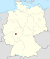
Karte Giessen in Deutschland.png 188 × 235; 5 KB
-
Karte Gießen Ortsbezirk Allendorf.png 1,200 × 1,053; 220 KB
-
Karte Gießen Ortsbezirk Kleinlinden.png 1,200 × 1,053; 220 KB
-
Karte Gießen Ortsbezirk Lützellinden.png 1,200 × 1,053; 225 KB
-
Karte Gießen Ortsbezirk Rödgen.png 1,200 × 1,053; 220 KB
-
Karte Gießen Ortsbezirk Wieseck.png 1,200 × 1,053; 223 KB
-
Karte Gießen Ortsbezirke.png 1,200 × 1,053; 213 KB
-
Karte Gießen.png 1,200 × 1,053; 251 KB
-
Karte Gießener Ring.svg 1,033 × 933; 2.51 MB
-
Kassel regionen.jpg 761 × 764; 118 KB
-
Lageplan des Brandplatzes und der Umgebung zu Gießen.jpg 12,000 × 2,514; 8.2 MB
-
Landkreis Gießen Gießen.png 873 × 683; 92 KB


