Category:Maps of Germany in the 10th century
Jump to navigation
Jump to search
English: This category is about the subject of  Germany 901-1000 CE: History maps showing all or a substantial part of the territory of Germany as it was in the 10th century.
Contemporary old maps belong into: Category:Old maps of Germany and its subcategories.
Contemporary old maps belong into: Category:Old maps of Germany and its subcategories.
Maps of the history of Germany: (BCE) (CE) 8th century · 9th century · 10th century · 11th century · 12th century · 13th century · 14th century · 15th century · 16th century · 17th century · 18th century · 19th century · 20th century · 21st century ·
Media in category "Maps of Germany in the 10th century"
The following 6 files are in this category, out of 6 total.
-
 Central Europe 919-1125.jpg 1,900 × 1,536; 843 KB
-
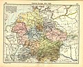
 Germany from the start of the tenth century to 1137.jpg 3,359 × 2,792; 2.83 MB
-
 Lotharingia-959 with current borders.svg 512 × 751; 416 KB
-
 Modern history; Europe (1904) (14765415832).jpg 2,028 × 3,008; 2.05 MB
-
 Putz83.jpg 678 × 800; 115 KB
-
 Spruner-Menke Handatlas 1880 Karte 37.jpg 10,386 × 8,705; 21 MB


_(14765415832).jpg)

