Category:Maps of French Morocco
Jump to navigation
Jump to search
Media in category "Maps of French Morocco"
The following 60 files are in this category, out of 60 total.
-
Carte du Maroc. G. Peltier delt. (Signé - A. Cuénot, cartographe.) - btv1b53063376t.jpg 8,976 × 7,256; 9.69 MB
-
Carte géologique provisoire du Maroc - par Louis Gentil... - btv1b53198385q.jpg 9,154 × 6,857; 12.34 MB
-
ETH-BIB-Marokko, Etappen der französ. Pacification-Dia 247-Z-00067.tif 3,664 × 2,878; 30.25 MB
-
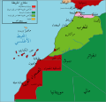
French conquest of Morocco-ar.png 752 × 538; 165 KB
-
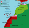
French conquest of Morocco.png 752 × 538; 158 KB
-
Mapa de África Occicdental hasta 1956.png 1,210 × 1,210; 270 KB
-
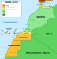
Mapa del Magreb (1956)-ast.svg 1,700 × 1,750; 556 KB
-
Mapa del Magreb (1956).svg 1,700 × 1,750; 573 KB
-
Mapa del Magreb (1958).svg 1,700 × 1,750; 568 KB
-
Mapa del Magreb (1959).svg 1,700 × 1,750; 553 KB
-
Maroc - btv1b8458910d.jpg 5,138 × 3,911; 3.12 MB
-
Maroc - carte administrative - btv1b53064386k.jpg 8,179 × 6,589; 6.15 MB
-
Maroc - carte administrative - btv1b530646428.jpg 9,396 × 7,359; 8.24 MB
-
Maroc - carte administrative - btv1b53064764c.jpg 9,149 × 6,908; 7.37 MB
-
Maroc - carte administrative et militaire - btv1b53064400z.jpg 9,057 × 7,329; 7.04 MB
-
Maroc - carte administrative et militaire - btv1b53064451g.jpg 8,705 × 6,903; 7.17 MB
-
Maroc - carte administrative et militaire - btv1b530645546.jpg 7,875 × 6,717; 7.45 MB
-
Maroc - carte administrative et militaire - btv1b53064573k.jpg 8,405 × 6,897; 7.48 MB
-
Maroc - carte administrative et militaire - btv1b53064733p.jpg 8,111 × 6,668; 7.22 MB
-
Maroc - carte administrative et militaire - btv1b530647935.jpg 8,571 × 6,995; 7.31 MB
-
Maroc - carte administrative et militaire - btv1b53064797z.jpg 9,370 × 7,365; 7.07 MB
-
Maroc - carte des terrains d'atterissage - btv1b8446472w.jpg 10,500 × 8,760; 10.65 MB
-
Maroc - carte dressée sous la direction de Henry Barrère... - btv1b53063490b.jpg 15,147 × 11,874; 28.17 MB
-
Maroc au - 1-1.500.000 - btv1b531000997.jpg 7,978 × 6,455; 7.78 MB
-
Maroc au - 1-1.500.000 - btv1b53100100v.jpg 8,244 × 6,458; 7.79 MB
-
Maroc au - 1-1.500.000. Les étapes de l'occupation française - btv1b53064544s.jpg 8,733 × 6,805; 8.33 MB
-
Maroc au - 1-1.500.000. Les étapes de la pacification française - btv1b530647700.jpg 8,163 × 6,564; 7.78 MB
-
Maroc au 1 - 1.500.000. Carte administrative 1948 - btv1b53197081f.jpg 10,770 × 7,614; 7.03 MB
-
Maroc au 1 - 1.500.000. Carte kilométrique des routes et des chemins de fer - btv1b53197079m.jpg 10,756 × 7,604; 8.59 MB
-
Maroc au 1 - 1.500.000. Carte kilométrique des routes et des chemins de fer - btv1b531970800.jpg 10,764 × 7,606; 7.37 MB
-
Maroc au 1-1.500.000 - btv1b530646032.jpg 8,147 × 6,493; 6.56 MB
-
Maroc au 1-1.500.000. Carte économique - btv1b53019737n.jpg 8,115 × 6,548; 8.02 MB
-
Maroc au 1.500.000e. Carte kilométrique des routes et chemins de fer - btv1b53064825j.jpg 8,458 × 6,734; 6.55 MB
-
Maroc sans cadre.svg 406 × 388; 249 KB
-
Maroc, réseau télégraphique - btv1b53063359b.jpg 9,248 × 7,272; 6.42 MB
-
Maroc. 1 - 1.500.000. Carte administrative - btv1b531212453.jpg 9,766 × 8,192; 6.36 MB
-
Marrocoprotectorate.png 406 × 388; 63 KB
-
Marruecos1933.PNG 971 × 755; 46 KB
-
Morocco Protectorate (rus).png 406 × 388; 45 KB
-
Morocco Protectorate (rus).svg 406 × 388; 667 KB
-
Morocco Protectorate de.svg 731 × 699; 18 KB
-
Morocco Protectorate lt.svg 731 × 699; 21 KB
-
Morocco Protectorate-ar.svg 433 × 414; 943 KB
-
Morocco Protectorate-HE.svg 406 × 388; 663 KB
-
Morocco Protectorate-hu.svg 406 × 388; 708 KB
-
Morocco Protectorate.svg 406 × 388; 815 KB
-
Morocco1912-1940-1945-1956.PNG 1,000 × 951; 92 KB
-
Morocco3Protection.png 406 × 388; 30 KB
-
ProtectoradoMarruecos-ar.png 406 × 388; 44 KB
-
ProtectoradoMarruecos.png 406 × 388; 44 KB
-
Saharaoccidentales.svg 627 × 599; 149 KB
-
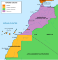
Territorios Españois e Francos en África do Norte.PNG 406 × 388; 47 KB
-
מרוקו הצרפתית.png 900 × 469; 21 KB
-
خريطة لمراحل احتلال المغرب 1920.jpg 8,446 × 6,834; 8.77 MB


