Category:Maps of Freiberg (Sachsen)
Jump to navigation
Jump to search
Wikimedia category | |||||
| Upload media | |||||
| Instance of | |||||
|---|---|---|---|---|---|
| Category combines topics | |||||
| Freiberg | |||||
town in Saxony, Germany | |||||
| Instance of |
| ||||
| Location | Mittelsachsen, Saxony, Germany | ||||
| Located in or next to body of water | |||||
| Head of government |
| ||||
| Inception |
| ||||
| Population |
| ||||
| Area |
| ||||
| Elevation above sea level |
| ||||
| Different from | |||||
| official website | |||||
 | |||||
Subcategories
This category has only the following subcategory.
Media in category "Maps of Freiberg (Sachsen)"
The following 17 files are in this category, out of 17 total.
-
AHS Freiberg.jpg 791 × 775; 223 KB
-
Bergbau bei Freiberg 1745.jpg 3,701 × 4,637; 4.54 MB
-
Das Rad in Silberstadt Freiberg während der Drehung..IMG 9680WI.jpg 1,978 × 2,592; 4.03 MB
-
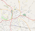
FG Innercity 2009.png 1,300 × 1,166; 650 KB
-
FG innercitymap 1932.jpg 1,242 × 1,340; 647 KB
-
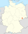
Freiberg Sachsen in Deutschland.png 188 × 235; 5 KB
-
Freiberg-1647-Merian-Belagerung.jpg 3,176 × 2,515; 2.36 MB
-
FreibergPlan.png 759 × 528; 114 KB
-
Gangkarte freiberg.jpg 5,601 × 8,518; 1.45 MB
-
Grundriss Freiberg 1786.jpg 7,745 × 4,900; 11.58 MB
-
Karte von Freiberg (um 1750).tif 3,315 × 4,347; 4.88 MB
-
Lage Freiberg in Deutschland.png 138 × 164; 11 KB
-
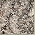
Meilenblatt B 231 Freiberg.jpg 8,990 × 8,980; 29.84 MB
-
Meilenblatt B 232 Hilbersdorf.jpg 8,990 × 8,980; 29.67 MB
-
Merian freiberg sachsen 1643 wikipedia.jpg 1,156 × 922; 513 KB
-
Rad in Silberstadt Freiberg...IMG 9682BE.jpg 2,622 × 2,592; 4.5 MB
-
Stadtplan Weinhold 1862 S 2.jpg 7,310 × 5,821; 1,010 KB


