Category:Maps of Flushing Meadows–Corona Park
Jump to navigation
Jump to search
Media in category "Maps of Flushing Meadows–Corona Park"
The following 13 files are in this category, out of 13 total.
-
-

-

-
 30 years of progress, 1934-1964 - Clearview Expressway.jpg 853 × 1,544; 262 KB
-
 For Your Convenience, A Map of the New York 1940 Worlds Fair. (5381149284).jpg 3,072 × 4,384; 10.06 MB
-
 Map-Six-and-Ten-Day-Race.jpg 885 × 655; 571 KB
-
 Model of 1964 New York World's Fair (50396067617).jpg 1,234 × 855; 1.52 MB
-
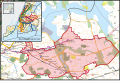 New York's 6th congressional district (new version) (since 2025).svg 1,600 × 1,069; 1.58 MB
-
 NYCWorldFair1939.jpg 756 × 500; 204 KB
-

-

-
 New York State Senate District 12 (2012).png 2,740 × 2,480; 541 KB
-

_-_Queens_County_-_Queens_-_ED_41-1_to_2176_-_NARA_-_24519584_(page_3).jpg)
_-_Queens_County_-_Queens_-_ED_41-1_to_2176_-_NARA_-_24519584_(page_7).jpg)
.jpg)

.jpg)
_(since_2025).svg)

.png)
