Category:Maps of European Upper Paleolithic
Jump to navigation
Jump to search
Media in category "Maps of European Upper Paleolithic"
The following 61 files are in this category, out of 61 total.
-
8500bce.PNG 471 × 380; 13 KB
-
Ancylus Lakey 7500-BC bulgarian.png 800 × 1,087; 366 KB
-
Ancylussee.svg 961 × 1,306; 672 KB
-
Aurignacian culture map-de.svg 720 × 540; 417 KB
-
Aurignacian culture map-es.png 767 × 575; 243 KB
-
Aurignacian culture map-es.svg 720 × 540; 354 KB
-
Aurignacian culture map-fr.svg 720 × 540; 99 KB
-
Badegoulian culture map 3.png 1,003 × 739; 776 KB
-
Badegoulian culture map.png 602 × 738; 804 KB
-
Badegoulien culture map 2.png 800 × 957; 913 KB
-
Baltic History 5000-BC-es.svg 961 × 1,306; 790 KB
-
Baltic History 5000-BC.svg 961 × 1,306; 721 KB
-
Baltic History 5500-BC.svg 961 × 1,306; 814 KB
-
Baltic History 7500-BC Ru.svg 961 × 1,306; 653 KB
-
Baltic History 7500-BC-ar.svg 961 × 1,306; 876 KB
-
Baltic History 7500-BC-es.svg 961 × 1,306; 757 KB
-
Baltic History 7500-BC.png 800 × 1,087; 342 KB
-
Baltic History 7500-BC.svg 961 × 1,306; 652 KB
-
Baltic History 8000-BC.svg 961 × 1,306; 652 KB
-
Baltischer EisstauseeX.png 2,000 × 2,684; 1.23 MB
-
Cartepaleosup froid.png 300 × 306; 12 KB
-
Cro-Magnon migration.gif 503 × 443; 127 KB
-
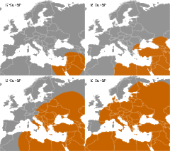
Cro-Magnon range 30,000 ybp.svg 147 × 130; 286 KB
-
Cro-Magnon range 32,500 ybp.svg 147 × 130; 294 KB
-
Cro-Magnon range 35,000 ybp.svg 147 × 130; 275 KB
-
Cro-Magnon range 37,500 ybp.svg 147 × 130; 271 KB
-
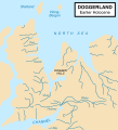
Doggerland-cy.svg 545 × 600; 122 KB
-
Doggerland.svg 545 × 600; 165 KB
-
Europe20000ya.png 1,900 × 1,264; 98 KB
-
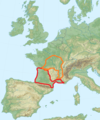
Franco-Cantabrian region.gif 956 × 482; 21 KB
-
Hamburg culture map 2.png 978 × 671; 606 KB
-
Hamburg culture map.png 1,316 × 805; 943 KB
-
Homo Sapiens in Europe - magdalenian distribution map-de.svg 2,000 × 1,150; 121 KB
-
Homo Sapiens in Europe - magdalenian distribution map-es.svg 2,000 × 1,150; 592 KB
-
Homo Sapiens in Europe - magdalenian distribution map-fr.svg 2,000 × 1,150; 127 KB
-
Homo Sapiens in Europe - solutrean distribution map-de.svg 1,150 × 760; 59 KB
-
Homo Sapiens in Europe - solutrean distribution map-en.svg 1,227 × 811; 58 KB
-
Homo Sapiens in Europe - solutrean distribution map-es.svg 1,150 × 760; 237 KB
-
Homo Sapiens in Europe - solutrean distribution map-fr.svg 1,150 × 760; 59 KB
-
Janisławicka.jpg 854 × 622; 484 KB
-
Kompleks Jerzmanowician-Ranisian-Lincombian zasięg.jpg 788 × 490; 337 KB
-
Kultura ahrensburska.jpg 834 × 612; 471 KB
-
Kultura azylska.jpg 682 × 551; 345 KB
-
Kultura lyngbijska.jpg 852 × 512; 375 KB
-
Kultura oryniacka.jpg 1,197 × 783; 924 KB
-
Kultura szelecka zasięg.jpg 672 × 552; 337 KB
-
Kulture desneńska zasięg.jpg 780 × 534; 386 KB
-
Lepenski vir culture-sr.png 822 × 650; 29 KB
-
Lepenski vir culture.png 822 × 650; 34 KB
-
Litorinameri 5000 eaa.svg 961 × 1,306; 697 KB
-
Map of Palaeolithic Art.png 906 × 567; 333 KB
-
Nordsjølandet.JPG 385 × 443; 73 KB
-
Palaeolithic migrations.jpg 7,140 × 2,944; 3.48 MB
-
Swiderian culture.jpg 544 × 423; 217 KB
-
Swiderien.svg 959 × 940; 899 KB
-
The American Museum journal (1912) (18156934902).jpg 3,780 × 1,696; 1 MB
-
Upper Paleolihic Art in Europe.gif 570 × 388; 18 KB
-
Yolda MeerX.png 1,994 × 2,716; 1.21 MB
-
Анцилово море (7500 - 6000 г. преди новата ера).png 4,608 × 5,112; 671 KB
-
Анциловото езеро.png 800 × 1,087; 366 KB
-
Литорино море (5 000 г.пр.н.е.).png 800 × 1,087; 363 KB


