Category:Maps of Eschweiler
Jump to navigation
Jump to search
Wikimedia category | |||||
| Upload media | |||||
| Instance of | |||||
|---|---|---|---|---|---|
| Category combines topics | |||||
| Eschweiler | |||||
municipality in the district of Aachen, in North Rhine-Westphalia, Germany | |||||
| Instance of |
| ||||
| Location |
| ||||
| Located in or next to body of water | |||||
| Head of government |
| ||||
| Population |
| ||||
| Area |
| ||||
| Elevation above sea level |
| ||||
| Different from | |||||
| official website | |||||
 | |||||
Media in category "Maps of Eschweiler"
The following 24 files are in this category, out of 24 total.
-
Area of eschweiler and stolberg.svg 402 × 639; 27 KB
-
Bahnstrecke-weisweiler-langerwehe.png 1,993 × 1,205; 1.42 MB
-
Bahnstrecken Eschweiler.png 3,908 × 1,549; 2.35 MB
-
Eschweiler (Allemagne) OSM 01.png 576 × 554; 223 KB
-
Eschweiler (Allemagne) OSM 02.png 576 × 554; 369 KB
-
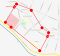
Eschweiler Bereich Innenstadt.svg 512 × 357; 350 KB
-
Eschweiler in AC (2009).svg 379 × 516; 271 KB
-
Eschweiler Innenstadt mit Stadtmauer.png 1,500 × 1,401; 117 KB
-
Eschweiler Innenstadt mit Stadtmauer.svg 512 × 478; 591 KB
-
Eschweileroverview.png 1,578 × 1,494; 141 KB
-
EW-Stadtwald-Wegeplan.jpg 1,200 × 1,600; 1.43 MB
-
Ewentwicklung1800.JPG 691 × 821; 63 KB
-
Ewentwicklung1900.JPG 691 × 821; 63 KB
-
Ewentwicklung1932.jpg 691 × 821; 63 KB
-
Ewentwicklung1935.JPG 691 × 821; 64 KB
-
Ewentwicklung1972.JPG 691 × 821; 63 KB
-
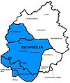
Gliederung der Stadt Eschweiler.svg 512 × 554; 133 KB
-
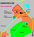
Kinzweiler.jpg 524 × 557; 38 KB
-
Lage der Flur Birkengang.png 821 × 717; 1.14 MB
-
Lage der Stadt Eschweiler in Deutschland.png 188 × 235; 5 KB
-
Raum-ewst-plz.jpg 274 × 438; 26 KB
-
Stadtplan Eschweiler Rhld.png 5,074 × 9,155; 17.46 MB
-
Staedteregion aachen ew-st.jpg 480 × 710; 37 KB
-
Stillgelegte Grube Birkengang, 1803 bis 1883.jpg 994 × 728; 322 KB


