Category:Maps of England in the 9th century
Jump to navigation
Jump to search
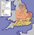
English: This category is about the subject of  England 801-900 CE: History maps showing all or a substantial part of the territory of England as it was in the 9th century.
Contemporary old maps belong into: Category:Old maps of England and its subcategories.
Contemporary old maps belong into: Category:Old maps of England and its subcategories.
Maps of the history of England: 1st century · 2nd century · 3rd century · 4th century · 5th century · 6th century · 7th century · 8th century · 9th century · 10th century · 11th century · 12th century · 13th century · 14th century · 15th century · 16th century · 17th century · 18th century · 19th century ·
Media in category "Maps of England in the 9th century"
The following 48 files are in this category, out of 48 total.
-
C. 886 England.jpg 913 × 1,023; 1.07 MB
-
Angelrucu 800 gear on russlendisc.svg 672 × 1,190; 65 KB
-
Angleterre 871.png 377 × 335; 27 KB
-
Angleterre 886.png 377 × 334; 27 KB
-
Angleterre 897.png 377 × 350; 25 KB
-
Anglia w roku878.svg 874 × 1,142; 1.31 MB
-
British kingdoms c 800-pt.svg 672 × 1,190; 205 KB
-
British kingdoms c 800.svg 672 × 1,190; 279 KB
-
Dialekty języka staroangielskiego.png 720 × 960; 122 KB
-
Egbert of Wessex map.jpg 702 × 733; 136 KB
-
England 878 de.svg 988 × 1,229; 1.63 MB
-
England 878 hu.svg 988 × 1,229; 1.36 MB
-
England 878 pl.svg 988 × 1,229; 1.55 MB
-
England 878-cy.svg 988 × 1,229; 1.38 MB
-
England 878-es.svg 988 × 1,229; 337 KB
-
England 878-fr.svg 988 × 1,229; 1.43 MB
-
England 878-nl.svg 988 × 1,229; 1.53 MB
-
England 878.svg 988 × 1,229; 1.54 MB
-
England Grosses Heer 865.jpg 848 × 868; 144 KB
-
England Grosses Heer 865.png 848 × 868; 711 KB
-
England Grosses Heer 892.jpg 848 × 868; 146 KB
-
England-878ad.jpg 735 × 935; 127 KB
-
Great Heathen Army-es.svg 551 × 551; 454 KB
-
Great Heathen Army-fr.svg 551 × 551; 172 KB
-
Great Heathen Army-pt.svg 551 × 551; 496 KB
-
GreatBritain802.png 323 × 480; 31 KB
-
Kingdom of East Anglia Map c.870.png 1,985 × 1,686; 209 KB
-
Kingdom of Wessex Map c.879.png 1,985 × 1,686; 153 KB
-
Map Coenwulf-fr.svg 952 × 712; 1.72 MB
-
Map Eardwulf-fr.svg 658 × 686; 1.31 MB
-
Map Eardwulf-pt.svg 658 × 686; 1.31 MB
-
Map Egbert of Wessex-fr.svg 952 × 712; 1.32 MB
-
Map Egbert of Wessex.svg 952 × 712; 1.32 MB
-
Map of Wessex in 879.png 988 × 1,229; 115 KB
-
Map Wiglaf of Mercia-fr.svg 952 × 712; 1.31 MB
-
Map Æthelbald of Wessex-fr.svg 946 × 372; 1.31 MB
-
Map Æthelberht of Wessex-fr.svg 946 × 372; 1.32 MB
-
Map Æthelred of Wessex-fr.svg 946 × 372; 1.32 MB
-
Northumbria 802.jpg 1,800 × 2,218; 649 KB
-
Northumbria terriory (c.802).png 1,155 × 1,500; 118 KB
-
Old English Dialects.png 720 × 960; 100 KB
-
The dawn of American history in Europe (1912) (14764061502).jpg 1,594 × 2,194; 455 KB
-
Ubba (map).png 890 × 556; 128 KB
-
Viking Raids in England 892-896-es.svg 685 × 539; 775 KB
-
Viking Raids in England 892-896-fr.svg 685 × 539; 768 KB
-
Viking Raids in England 892-896-pt.svg 685 × 539; 772 KB
-
Wessex territory (c.879).png 1,155 × 1,500; 117 KB
-
Æthelwulf and sons.png 699 × 502; 64 KB


