Category:Maps of Eger by Braun & Hogenberg
Jump to navigation
Jump to search
English: These maps of Eger (Agria) are not to be confused with maps of Cheb (Eger)
Media in category "Maps of Eger by Braun & Hogenberg"
The following 6 files are in this category, out of 6 total.
-

-
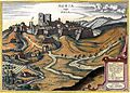
 AGRIA vulgo ERLA.jpg 1,462 × 1,187; 648 KB
-
 Agria BRAUN-HOGENBERG Civitates Orbis Terrarum Köln 1617..jpg 2,654 × 1,880; 7.56 MB
-
 Agria vulgo Erla.JPG 2,654 × 1,880; 1.05 MB
-
 Eger G Hoefnagel.jpg 3,085 × 2,221; 2.71 MB
-
 Theatri praecipvarvm totivs mvndi vrbivm - liber sextvs 1618 (97692607).jpg 15,484 × 10,336; 31.4 MB
o_1617_-_btv1b53194554d_(2_of_3).jpg)


.jpg)