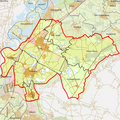
Category:Maps of Echt-Susteren
Jump to navigation
Jump to search
Wikimedia category | |||||
| Upload media | |||||
| Instance of | |||||
|---|---|---|---|---|---|
| Category combines topics | |||||
| Echt-Susteren | |||||
municipality in Limburg, the Netherlands | |||||
| Instance of |
| ||||
| Location | Limburg, Netherlands | ||||
| Population |
| ||||
| Area |
| ||||
| Elevation above sea level |
| ||||
| Replaces |
| ||||
| official website | |||||
 | |||||
Subcategories
This category has the following 2 subcategories, out of 2 total.
Media in category "Maps of Echt-Susteren"
The following 21 files are in this category, out of 21 total.
-
Map - NL - Municipality code 1711 (2009).svg 300 × 160; 530 KB
-
2013-EchtSusteren.jpg 3,040 × 2,315; 3.59 MB
-
2013-Top33-gem-Echt-Susteren.jpg 2,092 × 1,550; 1.93 MB
-
BAG woonplaatsen - Gemeente Echt-Susteren.png 2,419 × 2,419; 854 KB
-
Gem-Echt-Susteren-2014Q1.jpg 6,095 × 4,635; 13.91 MB
-
Gem-Echt-Susteren-OpenTopo.jpg 7,347 × 5,382; 6.22 MB
-
Karte Isenbrucher Mühle.jpg 900 × 600; 108 KB
-
LocatieDieteren.png 280 × 130; 6 KB
-
LocatieEcht-Susteren.png 280 × 130; 7 KB
-
LocatieEcht.png 280 × 130; 6 KB
-
LocatieKoningsbosch.png 280 × 130; 6 KB
-
LocatieMariahoop.png 280 × 130; 6 KB
-
LocatieNieuwstadt.png 280 × 130; 6 KB
-
LocatiePey.png 280 × 130; 6 KB
-
LocatieRoosteren.png 280 × 130; 6 KB
-
LocatieSintJoost.png 280 × 130; 6 KB
-
LocatieSusteren.png 280 × 130; 6 KB
-
Map - NL - Echt-Susteren (2009).svg 625 × 575; 1.87 MB
-
Natura 2000 - Abdij Lilbosch & voormalig Klooster Mariahoop.jpg 630 × 473; 38 KB
-
Nieuwstadt susteren 1653.png 1,502 × 1,086; 1.22 MB
-
SusterenLanddekenaatKaart.jpg 2,536 × 3,492; 2.23 MB


