Category:Maps of Eastern Galicia
Jump to navigation
Jump to search
Subcategories
This category has only the following subcategory.
Media in category "Maps of Eastern Galicia"
The following 15 files are in this category, out of 15 total.
-
EastGalicia1900GreekCatholic.PNG 653 × 784; 44 KB
-
EastGalicia1900Judaism.PNG 653 × 784; 42 KB
-
EastGalicia1900Protestant.PNG 653 × 784; 38 KB
-
EastGalicia1900RomanCatholic.PNG 653 × 784; 43 KB
-
Ethnographic map of the Ruthenian populaton of Galicia and Bukovina 1878.jpg 2,650 × 1,881; 2.23 MB
-
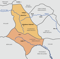
Galicia-Volhynia map.PNG 661 × 655; 41 KB
-
Galicja Wschodnia powiaty (ukr) 1910.png 1,299 × 1,136; 837 KB
-
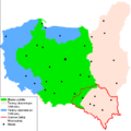
Galicja Wschodnia w II RP i III RP.PNG 889 × 892; 39 KB
-
KreisLemberg1855.png 699 × 654; 978 KB
-
Linia Barthelemy.PNG 598 × 580; 31 KB
-
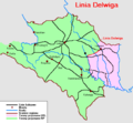
Linia Delwiga.PNG 628 × 581; 28 KB
-
MapaDelPrincipadoDeGalitzia-Volynia.svg 661 × 655; 1.3 MB
-
OstGalizien1855EthnischeKarte.jpg 2,180 × 1,494; 1.19 MB
-
Галичина сучасна 2013.png 709 × 900; 233 KB
-
Карта Восточной Галиции.jpg 9,064 × 6,833; 22.76 MB


