Category:Maps of East Frisia
Jump to navigation
Jump to search
Wikimedia category | |||||
| Upload media | |||||
| Instance of | |||||
|---|---|---|---|---|---|
| Category combines topics | |||||
| East Frisia | |||||
historic and cultural region in Lower Saxony, Germany | |||||
| Instance of | |||||
| Part of |
| ||||
| Location | Lower Saxony, Germany | ||||
| Located in or next to body of water | |||||
| Has part(s) | |||||
| Different from | |||||
| official website | |||||
 | |||||
Subcategories
This category has the following 6 subcategories, out of 6 total.
D
E
M
O
Media in category "Maps of East Frisia"
The following 77 files are in this category, out of 77 total.
-
2000pxOstfrieslandkartekalp.jpg 2,000 × 1,810; 630 KB
-
Aast-Fraschlönj.svg 800 × 600; 1.15 MB
-
Admiralty Chart No 3761 Friesche Zeegat to Jade River, Published 1912, Large Corrections 1954.jpg 21,489 × 11,250; 36.66 MB
-
Apen - Bucksande + Nordloher Tief 01 ies.jpg 5,616 × 3,744; 18.78 MB
-
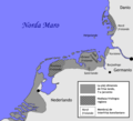
Friesische Seelande Brookmerland.PNG 1,191 × 666; 259 KB
-
Dollardpolders.jpg 1,498 × 1,454; 850 KB
-
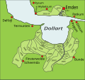
Dollart-Geschichte.svg 3,200 × 3,000; 53 KB
-
Emderstadtteile.svg 938 × 463; 162 KB
-
Emderstadtteiletransvaal.png 2,423 × 1,137; 279 KB
-
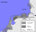
Friesengebiet-nds.png 769 × 697; 101 KB
-
Friesengebiet.png 769 × 697; 135 KB
-
Friesengebietblank.png 769 × 697; 82 KB
-
Friesische Seelande.png 1,191 × 666; 255 KB
-
Friesland region.png 360 × 300; 16 KB
-
Frisians-es.png 961 × 871; 236 KB
-
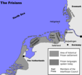
Frisians.png 769 × 697; 128 KB
-
Frislandoj.png 769 × 697; 41 KB
-
Greetsiel1748.jpg 1,175 × 918; 586 KB
-
Harlebucht Plan.jpg 851 × 939; 266 KB
-
Seelandeharlingerland.png 1,191 × 666; 254 KB
-
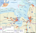
Jade-weser-muendung map de.png 800 × 743; 415 KB
-
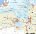
Jade-weser-muendung map de.svg 1,483 × 1,377; 617 KB
-
Jever Ostfriesland 1500.png 800 × 600; 1.13 MB
-
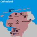
Judeninostfriesland.png 850 × 850; 88 KB
-
JudOstfriesland.png 823 × 817; 27 KB
-
Juist im Landkreis Aurich.png 931 × 670; 95 KB
-
Juist in districtul Aurich.png 931 × 670; 98 KB
-
Karte der Baptistengemeinden in Ostfriesland.png 1,576 × 1,271; 216 KB
-
Karte der Freikirchengemeinden in Ostfriesland.png 1,576 × 1,533; 315 KB
-
Karte Mittelpunkt Ostfriesland.jpg 3,024 × 4,032; 3.67 MB
-
Kloesterinostfriesland.png 2,000 × 1,722; 326 KB
-
Koenigreichholland.jpg 781 × 606; 371 KB
-
Lagekzengerhafe.jpg 380 × 281; 35 KB
-
Landkreis-leerhesel.png 575 × 386; 46 KB
-
Landkreis-leerleer.png 575 × 386; 46 KB
-
Stadtteileleer.svg 681 × 594; 77 KB
-
Lânkaart lokaasje Friso-Saksyske Talen.gif 329 × 456; 52 KB
-
Mittelpunkt Ostfriesland.jpg 3,024 × 4,032; 6.18 MB
-
Municipalities in East-Frisia.svg 2,442 × 2,210; 998 KB
-
NASA World Wind - Ostfriesland.png 1,280 × 1,024; 2.57 MB
-
Seelandenorden.png 1,191 × 666; 254 KB
-
Seelandeoestringen.png 1,191 × 666; 254 KB
-
Oost-Freesland nds.png 1,200 × 900; 193 KB
-
Orientfrislando mapo 2.jpg 380 × 281; 37 KB
-
Orientfrislando mapo.jpg 380 × 281; 40 KB
-
Ortsteilesbl.png 360 × 469; 28 KB
-
Ost-Friesland 02.png 2,000 × 1,500; 629 KB
-
Ost-Friesland blank.png 1,200 × 900; 149 KB
-
Ost-Friesland ro.png 1,200 × 900; 200 KB
-
Ost-Friesland.png 1,200 × 900; 221 KB
-
Ost-Friesland.svg 800 × 600; 895 KB
-
Ostfriesische Inseln (Karte).png 13,425 × 5,135; 6.04 MB
-
OstfriesischesPlatt.png 1,600 × 1,306; 493 KB
-
Ostfriesland de.svg 756 × 651; 382 KB
-
Ostfriesland es.svg 756 × 651; 349 KB
-
Ostfriesland fr.svg 756 × 651; 349 KB
-
Ostfriesland hervorgehoben mk.svg 600 × 550; 753 KB
-
Ostfriesland hervorgehoben.svg 600 × 550; 638 KB
-
Ostfriesland karte.jpg 380 × 281; 42 KB
-
Ostfriesland Orgellandschaft.svg 899 × 765; 563 KB
-
Ostfriesland ro.svg 756 × 651; 349 KB
-
Ostfriesland um 1300.png 1,500 × 1,063; 454 KB
-
Ostfriesland Verkehr-de.svg 740 × 568; 581 KB
-
Ostfriesland Verkehr-mk.svg 740 × 568; 770 KB
-
Ostfriesland-Globus 0479.jpg 5,779 × 3,854; 3.63 MB
-
Ostfriesland.png 1,279 × 1,384; 596 KB
-
Prusse1786.gif 760 × 464; 31 KB
-
Reiderland kaart.png 5,632 × 4,369; 40.25 MB
-
Teritoriul frizonilor.png 769 × 697; 136 KB
-
Seelandeauricherland.png 1,191 × 666; 241 KB
-
Seelandeemsigerland.png 1,191 × 666; 242 KB
-
Seelandefedergo.png 1,191 × 666; 241 KB
-
Seelandelengen.png 1,191 × 666; 254 KB
-
Seelanderheiderland.png 1,191 × 666; 254 KB
-
Seelanderuestringen.png 1,191 × 666; 254 KB
-
Seelandeverledingen.png 1,191 × 666; 254 KB
-
Weihnachtsflut61.jpg 2,048 × 1,749; 2.46 MB
