Category:Maps of Duchesne County, Utah (style B)
Jump to navigation
Jump to search
Media in category "Maps of Duchesne County, Utah (style B)"
The following 8 files are in this category, out of 8 total.
-
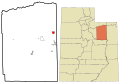
 Duchesne County Utah incorporated and unincorporated areas Altamont highlighted.svg 1,070 × 741; 9.82 MB
-
 Duchesne County Utah incorporated and unincorporated areas Bluebell highlighted.svg 1,070 × 741; 9.82 MB
-
 Duchesne County Utah incorporated and unincorporated areas Duchesne highlighted.svg 1,070 × 741; 9.82 MB
-
 Duchesne County Utah incorporated and unincorporated areas Myton highlighted.svg 1,070 × 741; 9.82 MB
-
 Duchesne County Utah incorporated and unincorporated areas Neola highlighted.svg 1,070 × 741; 9.82 MB
-
 Duchesne County Utah incorporated and unincorporated areas Roosevelt highlighted.svg 1,070 × 741; 9.82 MB
-
 Duchesne County Utah incorporated and unincorporated areas Tabiona highlighted.svg 1,070 × 741; 9.82 MB
-
 Duchesne County Utah incorporated and unincorporated areas.svg 1,070 × 741; 9.82 MB


