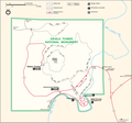
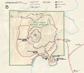
Category:Maps of Devils Tower National Monument
Jump to navigation
Jump to search
US national monuments: Agate Fossil Beds · Aztec Ruins · Bandelier · Cabrillo · Canyon de Chelly · Cedar Breaks · Colorado · Craters of the Moon · Devils Postpile · Devils Tower · Dinosaur · Effigy Mounds · Florissant Fossil Beds · Gila Cliff Dwellings · Hovenweep · Jewel Cave · John Day Fossil Beds · Lava Beds · Little Bighorn Battlefield · Montezuma Castle · Muir Woods · Natural Bridges · Organ Pipe Cactus · Rainbow Bridge · Statue of Liberty · Sunset Crater Volcano · Timpanogos Cave · Walnut Canyon · Wupatki ·
English: Maps of Devils Tower National Monument
Media in category "Maps of Devils Tower National Monument"
The following 7 files are in this category, out of 7 total.
-
Map of Devils Tower National Monument.png 1,538 × 1,438; 267 KB
-
NPS devils-tower-geologic-map.jpg 3,637 × 4,147; 2.99 MB
-
NPS devils-tower-land-cover-map.jpg 1,412 × 974; 250 KB
-
NPS devils-tower-map.jpg 1,195 × 1,045; 176 KB
-
NPS devils-tower-map.pdf 1,289 × 1,127; 1.22 MB
-
NPS devils-tower-topo-map.pdf 3,412 × 4,350; 16.63 MB
-
United States Statutes at Large Volume 34 Part 3 image following page 3236.png 1,532 × 2,398; 117 KB


