Category:Maps of Datteln
Jump to navigation
Jump to search
Kreis Recklinghausen  Castrop-Rauxel · Datteln · Dorsten · Gladbeck · Haltern · Herten · Marl · Oer-Erkenschwick · Recklinghausen · Waltrop ·
Wikimedia category | |||||
| Upload media | |||||
| Instance of | |||||
|---|---|---|---|---|---|
| Category combines topics | |||||
| Datteln | |||||
town in the district of Recklinghausen, in North Rhine-Westphalia, Germany | |||||
| Instance of |
| ||||
| Location | Recklinghausen, Münster Government Region, North Rhine-Westphalia, Germany | ||||
| Located in or next to body of water | |||||
| Population |
| ||||
| Area |
| ||||
| Elevation above sea level |
| ||||
| official website | |||||
 | |||||
Media in category "Maps of Datteln"
The following 16 files are in this category, out of 16 total.
-
Becklemer Baeche Einzugsgebietskarte.png 1,280 × 1,084; 2.42 MB
-
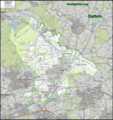
Datteln Gliederung.png 5,248 × 5,568; 35.21 MB
-
Datteln in RE.svg 423 × 340; 1.39 MB
-
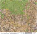
Haard Naturraumkarte.png 6,029 × 5,444; 39.03 MB
-
Horneburg in RE.png 2,000 × 1,608; 375 KB
-
Karte des Datteln-Hamm-Kanals.png 2,672 × 906; 1.2 MB
-
Messtischblatt 25 Horneburger Strasse 1907 vs 2013.png 5,329 × 2,027; 20.19 MB
-
Messtischblatt 25 Horneburger Strasse Uebersicht.png 5,329 × 2,027; 2.2 MB
-
Messtischblatt 25 Oer-Erkenschwick 1907 vs 2013.pdf 1,752 × 1,595, 2 pages; 13.58 MB
-
Messtischblatt 4309 Recklinghausen 1907 vs 2013.png 6,130 × 6,174; 73.25 MB
-
Messtischblatt 4309 Recklinghausen Uebersicht.png 6,130 × 6,174; 6.24 MB
-
Messtischblatt 4310 Waltrop 1907 Rechteck.jpg 7,318 × 7,054; 12.24 MB
-
Messtischblatt 4310 Waltrop 1907.jpg 8,100 × 8,545; 13.11 MB
-
Obervest Gliederung.jpg 11,549 × 8,401; 14.68 MB
-
Radrevier.ruhr Knotenpunkt 33 Schleuse Datteln Karte.jpg 3,672 × 4,896; 7.04 MB
-
Reichskarte 100 Datteln.png 2,702 × 2,393; 15.38 MB


