Category:Maps of Datong
Jump to navigation
Jump to search
Wikimedia category | |||||
| Upload media | |||||
| Instance of | |||||
|---|---|---|---|---|---|
| Category combines topics | |||||
| Datong | |||||
prefecture-level city in Shanxi, China | |||||
| Instance of | |||||
| Part of | |||||
| Location |
| ||||
| Capital | |||||
| Legislative body | |||||
| Population |
| ||||
| Area |
| ||||
| Elevation above sea level |
| ||||
| official website | |||||
 | |||||
Media in category "Maps of Datong"
The following 19 files are in this category, out of 19 total.
-
Guang yu tu - er juan LOC 2008623187-12.jpg 4,360 × 4,658; 4.31 MB
-
Guang yu tu - er juan LOC 2008623187-12.tif 4,360 × 4,658; 58.1 MB
-
Guang yu tu - er juan LOC 2008623187-6.jpg 4,360 × 4,658; 4.47 MB
-
Guang yu tu - er juan LOC 2008623187-6.tif 4,360 × 4,658; 58.1 MB
-
Administrative Division Datong 1.png 1,780 × 1,960; 219 KB
-
Administrative Division Datong.png 1,780 × 1,980; 222 KB
-
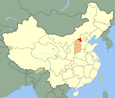
China Shanxi Datong.svg 1,000 × 850; 218 KB
-
Datong Administrative Division Plan.jpg 1,024 × 970; 157 KB
-
Datong Lage.jpg 379 × 295; 30 KB
-
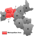
Datong mcp zh.png 315 × 339; 27 KB
-
Datong mcp.png 315 × 339; 25 KB
-
Datong Urban Plan 1938-1958.jpg 536 × 800; 173 KB
-
Datong Urban Plan 1955.jpg 1,024 × 895; 265 KB
-
Datong Urban Plan 1984-2000.jpg 1,024 × 1,417; 505 KB
-
Datong-map.png 800 × 874; 271 KB
-
Datong-map1.png 5,000 × 5,493; 2.16 MB
-
Datong.png 1,300 × 1,625; 461 KB
-
North Shanxi Autonomous Government Map, 1937.png 1,006 × 1,006; 1.94 MB
-
The map of the house of the prince of Dai.jpg 609 × 438; 101 KB


