Category:Maps of Coventry
Jump to navigation
Jump to search
Media in category "Maps of Coventry"
The following 11 files are in this category, out of 11 total.
-
City centre plan - geograph.org.uk - 1010833.jpg 640 × 532; 94 KB
-
Coventry Canal Map.png 1,203 × 1,567; 2.04 MB
-
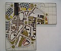
Coventry reconstruction model D 15518.jpg 778 × 618; 66 KB
-
Coventry ring road map.png 1,132 × 783; 1.07 MB
-
Coventry UK ward map 2024.svg 1,340 × 1,266; 260 KB
-
Coventry unparished area UK locator map.svg 1,340 × 1,266; 152 KB
-
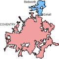
CoventryBedworthUrbanArea.svg 459 × 458; 36 KB
-
Location map United Kingdom Coventry Central.png 2,374 × 1,683; 3.74 MB
-
Ordnance Survey One-Inch Sheet 132 Coventry and Rugby, Published 1946 (Cov-Nun crop).jpg 1,500 × 3,234; 5.36 MB
-
Ordnance Survey Quarter-inch sheet 13 The Midlands, published 1962.jpg 9,697 × 8,913; 13.67 MB
-
Ordnance Survey Quarter-inch sheet 13 The Midlands, published 1965.jpg 9,704 × 8,949; 12.89 MB


