Category:Maps of Colchis
Jump to navigation
Jump to search
Wikimedia category | |||||
| Upload media | |||||
| Instance of | |||||
|---|---|---|---|---|---|
| Category combines topics | |||||
| Colchis | |||||
historical polity and region of Antiquity | |||||
| Instance of | |||||
| Capital | |||||
| Inception |
| ||||
| Dissolved, abolished or demolished date |
| ||||
 | |||||
Subcategories
This category has the following 2 subcategories, out of 2 total.
L
- Maps of Lazika (63 F)
P
Media in category "Maps of Colchis"
The following 164 files are in this category, out of 164 total.
-
Historical map of Georgia 1200 BC.svg 1,052 × 744; 109 KB
-
Historical map of Georgia 1118 BC.svg 1,052 × 744; 110 KB
-
1551 Venice Gastaldi-Descriptione de la Moscouia cropped.jpg 2,869 × 1,753; 1.35 MB
-
Banduri and Lisle. Imperii Orientalis et Circumjacentium Regionum.C (Iberia, Lazica).jpg 1,048 × 1,513; 319 KB
-
1842 map of Caucasus.jpg 852 × 679; 125 KB
-
1stMithritadicwar89BC-grc.svg 1,501 × 1,186; 80 KB
-
A-3-37-47-Colchis-Black-Sea-CaspianIberia-Albania.jpg 3,000 × 2,243; 1.21 MB
-
Alexander den stores rike, Nordisk familjebok Caucasus.jpg 782 × 512; 159 KB
-
Ancient Colchis. Erb-Satullo, N. (2022).png 1,299 × 1,299; 2.64 MB
-
Ancient countries of Transcaucasia.jpg 2,029 × 1,198; 1.09 MB
-
Ancient Kolchian littoral from Apsaros to Herakleion.png 2,500 × 1,610; 2.1 MB
-
Ancientcolchisandiberia andersen.png 869 × 613; 29 KB
-
Antoine Philippe Houze . L'Empire des Perses. 1844 (B).jpg 1,285 × 979; 217 KB
-
Armenia, Colchis, Iberia, Albania, Etc.jpg 3,231 × 2,079; 2.09 MB
-
Armenian4thcenturies.gif 699 × 456; 49 KB
-
Arsacid (Arshakouni) Armenia, 63-299 A.D..png 700 × 473; 63 KB
-
Asia minor-Shepherd 1923 Georgia.jpg 807 × 515; 65 KB
-
Cadusia.jpg 975 × 518; 93 KB
-
Caucasus 290 BC map alt de.svg 1,155 × 898; 4.42 MB
-
Caucasus 290 BC map de alt.png 3,000 × 2,332; 3.51 MB
-
Caucasus 290 BC map de.svg 1,155 × 898; 4.42 MB
-
Caucasus 290 BC map es.svg 1,155 × 898; 3.83 MB
-
Caucasus 290 BC map hu.svg 1,155 × 898; 4.42 MB
-
Caucasus 290 BC map ka.svg 1,155 × 898; 4.42 MB
-
Caucasus 290 BC map pt.svg 1,155 × 898; 4.41 MB
-
Caucasus 290 BD map de.png 3,000 × 2,332; 3.53 MB
-
Caucasus03333.jpg 778 × 600; 107 KB
-
Caucasus03-zh.jpg 874 × 645; 237 KB
-
Caucasus03-zh.png 874 × 645; 43 KB
-
Caucasus03.png 874 × 645; 40 KB
-
Caucasus03.jpg 874 × 645; 54 KB
-
Caucasus03 la.png 874 × 645; 44 KB
-
Caucasus03-es.svg 2,466 × 1,754; 227 KB
-
Caucasus03-sr.png 874 × 645; 41 KB
-
Caucasus Megrelian.jpg 874 × 645; 74 KB
-
Caucasus03 fr.png 874 × 645; 39 KB
-
Caucasus03RO.JPG 874 × 645; 56 KB
-
Armenia in 300 BC.png 850 × 607; 28 KB
-
Caucasus1stcentury-az.png 1,400 × 713; 85 KB
-
Caucasus1stcentury-nolegend-az.png 952 × 713; 59 KB
-
Central and southern parts of Colchis and part of Iberia.jpg 3,457 × 2,368; 6.43 MB
-
Cn Pompeius 66-64 BC Caucasus-es.svg 1,155 × 898; 3.91 MB
-
Cn Pompeius 66-64 BC Caucasus.png 1,780 × 1,108; 1.82 MB
-
Colchis and Iberia on Ptolemy Asia map.jpg 1,552 × 1,027; 345 KB
-
Colchis and Iberia, 1706.jpg 700 × 419; 165 KB
-
Colchis and Iberia, VI-III centuries B.C..jpg 1,280 × 992; 937 KB
-
Colchis between the Black and Caspian Seas.jpg 1,112 × 815; 319 KB
-
Colchis, Yberia, Giorgia, Mengrelia and Albania.jpg 625 × 285; 47 KB
-
Colchis.jpg 966 × 632; 235 KB
-
Diauehi.svg 770 × 550; 3.74 MB
-
Early Georgian States Colchis And Iberia he.svg 792 × 696; 3.78 MB
-
Early Georgian States Colchis And Iberia ka.svg 792 × 696; 3.78 MB
-
Earlycaucasus655.jpg 1,180 × 791; 555 KB
-
European and Asiatic Sarmatia 1794.JPG 2,116 × 1,508; 1.92 MB
-
Fotothek df tg 0005111 Geographie ^ Karte.jpg 800 × 672; 302 KB
-
Ge colxida.png 312 × 250; 14 KB
-
Georgia 1st 2nd centuries AD-ka.svg 1,333 × 1,047; 472 KB
-
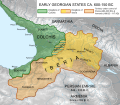
Georgian States Colchis and Iberia (600-150BC)-en.svg 792 × 696; 4.01 MB
-
Georgian States Colchis and Iberia (600-150BC)-es.svg 792 × 696; 3.77 MB
-
Georgian States Colchis and Iberia (600-150BC)-pt.svg 792 × 696; 3.77 MB
-
Georgianiberia andersen565.JPG 1,166 × 817; 381 KB
-
Gerard Mercator. Tabula Asiae III (Georgia).jpg 857 × 428; 161 KB
-
Gorgania on Fra Mauro map.jpg 616 × 282; 38 KB
-
Greek colonies of the Euxine Sea-pt.svg 1,280 × 684; 346 KB
-
Greek colonies of the Euxine Sea-zh.svg 1,280 × 684; 361 KB
-
Greek colonies of the Euxine Sea.svg 1,280 × 684; 349 KB
-
Greek colonies of the Northern Euxine Sea (Black Sea)-pt.svg 1,142 × 424; 314 KB
-
Greek colonies of the Northern Euxine Sea (Black Sea).svg 1,142 × 424; 289 KB
-
Görög gyarmatok a Fekete-tengernél i e 6 század.svg 1,771 × 1,254; 3.01 MB
-
Heinrich Kiepert. Asia citerior.Colchis.Iberia.jpg 1,464 × 509; 187 KB
-
Jean-Denis Barbié du Bocage. Carte du Palus Méotide et du Pont Euxin. 1781.jpg 3,576 × 2,776; 1.72 MB
-
Kolkhida.png 580 × 614; 39 KB
-
Kolxetis samefo.jpg 580 × 614; 111 KB
-
Locations of the Sanctuary of Leukothea in Kolchis.png 2,500 × 1,168; 1.81 MB
-
Map of Colchis, Iberia, Albania, and the neighbouring countries ca 1770.jpg 1,016 × 760; 194 KB
-
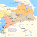
Map of Persian Armenia and its surroundings.svg 512 × 327; 57 KB
-
Map of the Armenian Empire of Tigranes (English).svg 512 × 506; 61 KB
-
MapoftheVoyageoftheArgonauts Black Sea.jpg 1,258 × 991; 1.45 MB
-
MapoftheVoyageoftheArgonauts Caucasus.jpg 712 × 561; 502 KB
-
Maps of the Armenian Empire of Tigranes-es.svg 1,975 × 1,958; 640 KB
-
Maps of the Armenian Empire of Tigranes-he.svg 512 × 506; 38 KB
-
Maps of the Armenian Empire of Tigranes-pt.svg 512 × 506; 50 KB
-
Maps of the Armenian Empire of Tigranes.gif 673 × 669; 56 KB
-
Persian Armenia-es.svg 1,030 × 656; 1.27 MB
-
Persian Armenia-fr.svg 512 × 327; 41 KB
-
Persian Armenia-hu.svg 675 × 431; 83 KB
-
Persian Armenia-pt.svg 512 × 327; 46 KB
-
Persian Armenia.gif 698 × 455; 53 KB
-
Pline l'Ancien. Asia circa Pontum Euxinum et Maeotim, ex Plinio. 17th century.jpg 2,268 × 1,677; 848 KB
-
Pontos and southern Kolchis from Sinope to Phasis.png 2,500 × 543; 987 KB
-
Pontus Armenia.jpg 1,220 × 1,046; 428 KB
-
Ptolemy 2nd cent 1.jpg 10,336 × 7,312; 21.43 MB
-
Rivers and cities of the Kolchian plain.png 2,500 × 1,609; 2.62 MB
-
Rivers of the Kolchian Plain.png 2,500 × 1,609; 2.53 MB
-
Roman East 50 CE Commagene highlighted-en.svg 2,717 × 1,595; 854 KB
-
Roman East 50 CE Commagene highlighted-zh.svg 3,396 × 1,993; 2.7 MB
-
Roman East 50-ang.svg 2,717 × 1,595; 822 KB
-
Roman East 50-en.svg 2,717 × 1,595; 848 KB
-
Roman East 50-es.svg 2,717 × 1,595; 3.6 MB
-
Roman East 50-fi.svg 2,717 × 1,595; 854 KB
-
Roman East 50-he.svg 2,717 × 1,595; 854 KB
-
Roman East 50-hu.svg 2,717 × 1,595; 858 KB
-
Roman East 50-it.svg 2,717 × 1,595; 857 KB
-
Roman East 50-pt.svg 2,717 × 1,595; 851 KB
-
Roman East 50-zh.svg 3,396 × 1,993; 2.68 MB
-
Roman-Parthian War 58-60-fi.svg 2,717 × 1,595; 552 KB
-
Roman-Parthian War 58-60-it.svg 2,750 × 1,790; 469 KB
-
Roman-Parthian War 58-60-vi.svg 512 × 300; 207 KB
-
Roman-Parthian War 58-60-zh.svg 4,188 × 2,531; 495 KB
-
Roman-Parthian War 58-60.es.svg 3,350 × 2,025; 558 KB
-
Roman-Parthian War 58-60.pt.svg 3,350 × 2,025; 556 KB
-
Roman-Parthian War 58-60.svg 3,350 × 2,025; 1.17 MB
-
Roman-Parthian War 61-63.es.svg 3,350 × 2,025; 454 KB
-
Roman-Parthian War 61-63.pt.svg 3,350 × 2,025; 458 KB
-
RomanPowerAsiaMinor90BCE.JPG 762 × 420; 119 KB
-
Sanson, Nicolas. Armenia maior, Colchis, Iberia, Albania. 1655.jpg 2,731 × 2,165; 1.37 MB
-
Sebastian Münster. Map of Colchis and Caucasian Iberia. 1544.GIF 1,237 × 834; 138 KB
-
Shepherd-c-020 cropped Armenia.jpg 451 × 423; 90 KB
-
TabulaPeutingeriana. Colchis&Iberia.jpg 2,753 × 397; 371 KB
-
Transcaucasia 2nd BC-ar.png 982 × 772; 445 KB
-
Transcaucasia 2nd BC.jpg 982 × 772; 232 KB
-
Urartu 610 585-pt.svg 2,714 × 1,740; 855 KB
-
Urartu 680 610-pt.svg 2,714 × 1,740; 885 KB
-
Urartu 713 680-pt.svg 2,714 × 1,740; 875 KB
-
Urartu 715 713-pt.svg 2,714 × 1,740; 878 KB
-
Urartu715-713.png 1,706 × 1,087; 163 KB
-
Whiston1736.jpg 674 × 800; 85 KB
-
Yervanduni Armenia, IV-II BC.gif 700 × 457; 58 KB
-
Հռոմեա-պարթևական պատերազմ, 58-60.svg 3,350 × 2,025; 513 KB


