Category:Maps of Coburg
Jump to navigation
Jump to search
Urban districts (cities): Amberg · Ansbach · Aschaffenburg · Augsburg · Bamberg · Bayreuth · Coburg · Erlangen · Fürth · Hof · Ingolstadt · Kaufbeuren · Kempten · Landshut · Memmingen · Munich · Nuremberg · Passau · Regensburg · Rosenheim · Schweinfurt · Straubing · Weiden in der Oberpfalz · Würzburg
Deutsch: Karten und Pläne der Stadt Coburg
Wikimedia category | |||||
| Upload media | |||||
| Instance of | |||||
|---|---|---|---|---|---|
| Category combines topics | |||||
| Coburg | |||||
town in Bavaria, Germany | |||||
| Pronunciation audio | |||||
| Instance of |
| ||||
| Part of |
| ||||
| Location |
| ||||
| Located in or next to body of water | |||||
| Street address |
| ||||
| Head of government |
| ||||
| Population |
| ||||
| Area |
| ||||
| Elevation above sea level |
| ||||
| Different from | |||||
| official website | |||||
 | |||||
Media in category "Maps of Coburg"
The following 32 files are in this category, out of 32 total.
-
Abgeleitete Karte von Bayern (Frankenwald).jpg 3,722 × 2,882; 3.25 MB
-
Bahnstrecken-Coburger-Land-2017.png 1,024 × 774; 377 KB
-
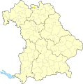
CO (St) in Bayern.svg 1,227 × 1,236; 311 KB
-
Coburg Adamiberg Plan 1940.png 2,027 × 3,097; 710 KB
-
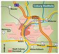
Coburg Stadtteil Beiersdorf.png 929 × 853; 268 KB
-
Coburg Stadtteil Bertelsdorf.png 929 × 853; 268 KB
-
Coburg Stadtteil CO Forst.png 929 × 853; 268 KB
-
Coburg Stadtteil Cortendorf.png 929 × 853; 268 KB
-
Coburg Stadtteil Creidlitz.png 929 × 853; 268 KB
-
Coburg Stadtteil Ketschendorf.png 929 × 853; 268 KB
-
Coburg Stadtteil Lützelbuch.png 929 × 853; 268 KB
-
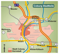
Coburg Stadtteil Neu- und Neershof.png 929 × 853; 268 KB
-
Coburg Stadtteil Neuses.png 929 × 853; 268 KB
-
Coburg Stadtteil Rögen.png 929 × 853; 268 KB
-
Coburg Stadtteil Scheuerfeld.png 929 × 853; 268 KB
-
Coburg Stadtteil Seidmannsdorf.png 929 × 853; 268 KB
-
Coburg Stadtteil Wüstenahorn.png 929 × 853; 268 KB
-
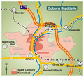
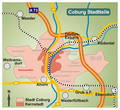
Coburg Stadtteile.png 787 × 787; 391 KB
-
Coburg-Friedhof.png 1,994 × 2,561; 658 KB
-
Coburg-Hofgarten.png 1,789 × 2,486; 805 KB
-
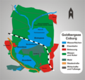
Goldbergsee Coburg.png 1,460 × 1,374; 396 KB
-
Hochwasserschutz Coburg.png 1,231 × 1,112; 303 KB
-
Karte coburg in deutschland.png 188 × 235; 5 KB
-
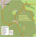
Karte Querkelfelsen Hohenstein.png 1,699 × 1,717; 388 KB
-
Karte Stadtgliederung Coburg.svg 527 × 365; 473 KB
-
Karte-HSC-Ex.png 675 × 571; 32 KB
-
Karte-HSC.png 2,343 × 1,951; 379 KB
-
Locator map CO (town) in Bavaria.svg 867 × 855; 1,000 KB
-
Logo Coburg-Stammtisch.jpg 1,573 × 1,556; 444 KB
-
Oberes Schloss Untersiemau Lageplan.jpg 1,835 × 1,261; 550 KB
-
Special Charte Des Gesamten Fürstenthums Coburg.jpg 7,796 × 6,914; 18.79 MB
-
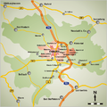
Stadtteile Coburg.png 929 × 853; 270 KB


