Category:Maps of Chiemsee (lake)
Jump to navigation
Jump to search
Wikimedia category | |||||
| Upload media | |||||
| Instance of | |||||
|---|---|---|---|---|---|
| Category combines topics | |||||
| Chiemsee | |||||
freshwater lake in Bavaria, Germany .jpg) Chiemsee   | |||||
| Instance of | |||||
| Located in protected area | |||||
| Location | Chiemsee, Traunstein, Upper Bavaria, Bavaria, Germany | ||||
| Heritage designation |
| ||||
| Width |
| ||||
| Length |
| ||||
| Area |
| ||||
| Elevation above sea level |
| ||||
| Inflows | |||||
| Outflows | |||||
| Drainage basin | |||||
| Basin country | |||||
| Different from | |||||
 | |||||
Deutsch: Karten zum Chiemsee
English: Maps of Chiemsee
Subcategories
This category has only the following subcategory.
B
- Bathymetric maps of Chiemsee (4 F)
Media in category "Maps of Chiemsee (lake)"
The following 17 files are in this category, out of 17 total.
-
 Chiemsee Karte Moränen Vergangenheit Zukunft (retuschiert).jpg 1,880 × 2,016; 2.2 MB
-
 Chiemsee Karte Moränen Vergangenheit Zukunft b.jpg 1,851 × 1,976; 1.36 MB
-
 Chiemsee Karte Moränen Vergangenheit Zukunft retusche.jpg 1,884 × 2,011; 3.09 MB
-
 Chiemsee Karte Moränen Vergangenheit Zukunft.jpg 1,977 × 2,203; 483 KB
-
 Chiemsee Karte Tiefen b.jpg 1,817 × 1,664; 624 KB
-
 Chiemsee Karte Tiefen retusche.jpg 1,853 × 1,711; 1.24 MB
-
 Chiemsee Karte Tiefen.jpg 1,959 × 1,893; 273 KB
-
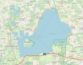 Chiemsee OSM.png 759 × 595; 276 KB
-
 Der Chiemsee, als er bis Marquartstein reichte.jpg 832 × 736; 446 KB
-
 Der Chiemsee, etwa nach 2500 Jahren.jpg 832 × 736; 427 KB
-
 Der Chiemsee, etwa nach 5000 Jahren.jpg 832 × 736; 409 KB
-
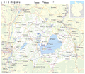 Karte Chiemgau.png 2,155 × 1,870; 1.33 MB
-
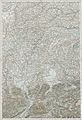 Kufstein - 30-48.jpg 3,390 × 4,959; 3.61 MB
-
 Location Chiemsee.PNG 717 × 442; 51 KB
-
 Moränenkarte des Chiemseegebietes.jpg 833 × 736; 454 KB
-
 OSM-Chiemgau.png 2,094 × 1,894; 2.82 MB
-
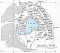
 Tiefenkarte Chiemsee 1906.jpg 930 × 778; 162 KB
.jpg)


