Category:Maps of Charleston, South Carolina
Jump to navigation
Jump to search
Wikimedia category | |||||
| Upload media | |||||
| Instance of | |||||
|---|---|---|---|---|---|
| Category combines topics | |||||
| Charleston | |||||
largest city in the U.S. state of South Carolina | |||||
| Instance of | |||||
| Named after | |||||
| Location | Charleston County, South Carolina | ||||
| Head of government |
| ||||
| Heritage designation |
| ||||
| Inception |
| ||||
| Significant event |
| ||||
| Population |
| ||||
| Area |
| ||||
| Elevation above sea level |
| ||||
| Different from | |||||
| official website | |||||
 | |||||
Subcategories
This category has the following 5 subcategories, out of 5 total.
- Maps of Fort Sumter (75 F)
P
Media in category "Maps of Charleston, South Carolina"
The following 20 files are in this category, out of 20 total.
-
Charleston earthquake map.pdf 1,114 × 1,500; 178 KB
-
Charleston Harbor 1861 (ita).png 998 × 777; 600 KB
-
Charleston Harbor 1861.png 1,693 × 1,321; 400 KB
-
Charleston Harbor 1861Heb.png 1,697 × 1,347; 283 KB
-
Charleston satellite map.jpg 549 × 782; 50 KB
-
Charleston, SC.png 1,212 × 731; 300 KB
-
CharlestonHarbor defenses.jpg 3,000 × 2,210; 3.38 MB
-
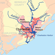
Charlestonriversmap (cropped).png 561 × 567; 197 KB
-
Charlestonriversmap.png 1,000 × 1,000; 395 KB
-
CHS Map.png 900 × 900; 205 KB
-
Colonial Lake map.PNG 734 × 500; 772 KB
-
Gadsden Creek Map.jpg 640 × 479; 205 KB
-
SC HD 99 2018 (Special) By Precinct.png 740 × 554; 63 KB
-
SCMap-doton-Awendaw.PNG 300 × 237; 12 KB
-
SCMap-doton-Charleston.PNG 300 × 237; 12 KB
-
US 52 Spur.PNG 422 × 359; 20 KB


