Category:Maps of Celtic people
Jump to navigation
Jump to search
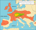
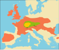
English: This is reserved for maps of the entire Celtic range or most of it.
Media in category "Maps of Celtic people"
The following 28 files are in this category, out of 28 total.
-
1000BC Migrations Europe.png 1,475 × 1,200; 1.56 MB
-
Europam sive Celticam Veterem.jpg 12,044 × 8,672; 23.58 MB
-
Celtes-carte.PNG 276 × 224; 6 KB
-
Celtic expansion in Europe.png 450 × 314; 14 KB
-
Celtic expansion in Europe.svg 933 × 690; 163 KB
-
Celtic Expansion jp.svg 1,149 × 803; 1.18 MB
-
Celtic expansion.PNG 450 × 314; 12 KB
-
Celtic Expansion.svg 1,149 × 803; 1.18 MB
-
Celts 800-400BC.PNG 450 × 319; 68 KB
-
Celts he.PNG 719 × 600; 77 KB
-
Celts in Europe with color key.jpg 450 × 456; 134 KB
-
Celts in Europe-fr.svg 933 × 690; 165 KB
-
Celts in Europe.png 450 × 314; 14 KB
-
Celts in III century BC.jpg 800 × 600; 139 KB
-
Celts ua.GIF 1,198 × 846; 42 KB
-
Celts, 3rd century BC.png 1,220 × 847; 75 KB
-
Celts, 4th century BC.png 1,220 × 847; 74 KB
-
Celts, 5th century BC.png 1,220 × 847; 73 KB
-
Celts.svg 1,068 × 891; 322 KB
-
East-Hem 500bc.jpg 3,240 × 1,903; 1.41 MB
-
Europam sive Celticam veterem (Europe).jpg 8,933 × 7,773; 7.94 MB
-
Europam, Sive Celticam Veterem 1595.jpg 920 × 698; 268 KB
-
Gaule -59.png 1,296 × 1,538; 903 KB
-
Hallstatt LaTene.png 600 × 438; 250 KB
-
L'expansion celte du VIe au IIIe siècle avant notre ère.jpg 2,552 × 2,073; 615 KB
-
LangCeltes.jpg 447 × 301; 84 KB
-
Maximum area of Celtic languages.png 450 × 314; 14 KB
-
Mediterrâneo pré-romano e Europa Celta.jpg 660 × 465; 52 KB


