Category:Maps of Carlisle
Jump to navigation
Jump to search
Media in category "Maps of Carlisle"
The following 15 files are in this category, out of 15 total.
-
13 Petriana.png 1,200 × 600; 1.79 MB
-
Befundskizze Luguvalium Carvetiorum (GB).png 1,324 × 1,048; 1.53 MB
-
Carlisle - Cumbria dot.png 417 × 599; 122 KB
-
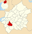
Carlisle unparished area UK locator map.svg 1,252 × 1,346; 831 KB
-
City of Carlisle Electric Tramways.jpg 600 × 600; 118 KB
-
Cumbria Z10 Mapnik OSM.png 913 × 939; 366 KB
-
Location map United Kingdom Carlisle Central.png 2,048 × 1,946; 1.37 MB
-
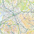
Ordnance Survey 1-250000 - NY.jpg 4,000 × 4,000; 8.08 MB
-
Ordnance Survey One-Inch Sheet 76 Carlisle, Published 1947.jpg 11,008 × 12,797; 16.57 MB
-
Ordnance Survey One-Inch Sheet 76 Carlisle, Published 1963.jpg 8,289 × 9,852; 11.18 MB
-
Ordnance Survey Quarter-inch sheet 2 Scotland south-west, published 1946.jpg 15,110 × 10,911; 17.48 MB
-
Ordnance Survey Quarter-inch Sheet 8 Solway Firth, Published 1966.jpg 9,650 × 8,880; 9.72 MB
-
Balquhidder, Dumfries & Gretna RJD 25.jpg 2,861 × 1,890; 617 KB
-
Roman Carlisle.png 800 × 457; 1.05 MB
-
ST Carlisle.png 1,200 × 600; 1.85 MB


