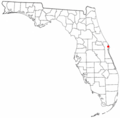
Category:Maps of Cape Canaveral and Merritt Island
Jump to navigation
Jump to search
Subcategories
This category has the following 2 subcategories, out of 2 total.
Media in category "Maps of Cape Canaveral and Merritt Island"
The following 5 files are in this category, out of 5 total.
-
Admiralty Chart No 269 Sapelo Sound to Little Bahama Bank, Published 1886.jpg 11,108 × 16,131; 44.07 MB
-
FLMap-doton-MerrittIsland.PNG 300 × 295; 12 KB
-
Merritt Island Map.jpg 386 × 372; 42 KB


