Category:Maps of Canaan
Jump to navigation
Jump to search
Wikimedia category | |||||
| Upload media | |||||
| Instance of | |||||
|---|---|---|---|---|---|
| Category combines topics | |||||
| Canaan | |||||
Semitic-speaking region and civilization in the Ancient Near East during the late 2nd millennium BC | |||||
| Instance of | |||||
| Named after |
| ||||
| Different from | |||||
 | |||||
Subcategories
This category has the following 3 subcategories, out of 3 total.
I
O
Media in category "Maps of Canaan"
The following 63 files are in this category, out of 63 total.
-
(ערי כנען בתקופת הברונזה (מפה.svg 512 × 1,129; 461 KB
-
12 Tribes of Israel Map zh hans.svg 2,168 × 3,300; 107 KB
-
12 Tribes of Israel Map zh hant.svg 2,168 × 3,300; 105 KB
-
12 Tribes of Israel Map(tp).svg 512 × 777; 248 KB
-
12 Tribes of Israel Map-ar.svg 2,168 × 3,300; 1.18 MB
-
12 Tribes of Israel Map-nl.svg 2,168 × 3,300; 53 KB
-
12 Tribes of Israel Map-pt.svg 2,168 × 3,300; 64 KB
-
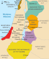
12 Tribes of Israel Map.svg 2,168 × 3,300; 149 KB
-
12 tribes of Israel ur.svg 2,168 × 3,300; 157 KB
-
12 tribus de Israel.svg 2,313 × 3,520; 1.19 MB
-
12 племен Ізраїля.png 2,713 × 4,000; 942 KB
-
12 племен Ізраїля.svg 2,168 × 3,300; 72 KB
-
545px-Levant 830-el.png 545 × 591; 57 KB
-
Amón 830-es.svg 605 × 706; 63 KB
-
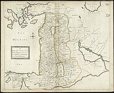
Canaan.jpg 171 × 236; 36 KB
-
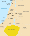
Edom 830-es.svg 605 × 706; 63 KB
-
Harta 8 Migraţia lui Avraam din Ur în Canaan.3D digital art.png 1,049 × 809; 2.05 MB
-
Israelites XeSiecle.jpg 595 × 673; 83 KB
-
Kenaan mapa s popisky.jpg 362 × 382; 176 KB
-
Kibush Canaan - yehoshua10.png 974 × 590; 113 KB
-
Kibush Canaan.png 1,710 × 2,612; 701 KB
-
Kibush cnaan 1.jpg 1,024 × 768; 142 KB
-
Kingdom of Ammon 830 map-ar.png 720 × 855; 106 KB
-
Kingdom of Ammon 830 map-pt.svg 720 × 859; 44 KB
-
Kingdom of Damascus 830 map-pt.svg 720 × 859; 44 KB
-
Kingdom of Edom 830 map-pt.svg 720 × 859; 44 KB
-
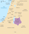
Kingdom of Moab 830 map-pt.svg 720 × 859; 44 KB
-
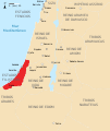
Kingdom of Philistines 830 map-es.svg 768 × 916; 232 KB
-
Kingdom of Philistines 830 map-pt.svg 720 × 859; 44 KB
-
Kingdoms around Israel 830 map sh.svg 720 × 859; 62 KB
-
Kingdoms around Israel 830 map sr.svg 720 × 859; 62 KB
-
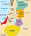
Kingdoms around Israel 830 map-de.png 1,004 × 1,198; 318 KB
-
Kingdoms around Israel 830 map-el.svg 720 × 859; 509 KB
-
Kingdoms around Israel 830 map-es.svg 768 × 916; 228 KB
-
Kingdoms around Israel 830 map-nl.svg 720 × 859; 479 KB
-
Kingdoms around Israel 830 map-pt.svg 720 × 859; 54 KB
-
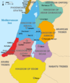
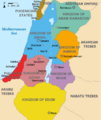
Kingdoms around Israel 830 map.svg 720 × 859; 122 KB
-
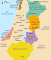
Kingdoms of Israel and Judah map 830-pt.svg 720 × 859; 45 KB
-
Kingdoms of the Levant Map 830.png 1,955 × 2,332; 438 KB
-
Kingdoms of the Levant Map 830.xcf 1,955 × 2,332; 941 KB
-
Levant 800.png 545 × 525; 19 KB
-
Levant 830 map-pt.svg 720 × 859; 44 KB
-
Levant 830 nl 3-ar.png 720 × 855; 105 KB
-
Levant 830 nl 3.PNG 771 × 839; 153 KB
-
Levant 830-nl.PNG 544 × 593; 26 KB
-
Levant 830.png 544 × 593; 26 KB
-
Levant Amarna.svg 354 × 615; 322 KB
-
Levante 800.jpg 617 × 599; 188 KB
-
Levante 830-es.svg 646 × 753; 262 KB
-
Levanti riigid.jpg 800 × 954; 280 KB
-
Mapa kraju Filistynów.JPG 363 × 573; 27 KB
-
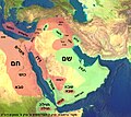
Middle East Shem-Ham-ar.jpg 1,333 × 1,193; 150 KB
-
Middle East Shem-Ham-he.jpg 1,000 × 895; 477 KB
-
Middle East Shem-Ham.jpg 1,000 × 895; 823 KB
-
Moab 830-es.svg 605 × 706; 63 KB
-
PelesetsCananeensIsraelites.jpg 547 × 620; 69 KB
-
Philistine language.svg 720 × 859; 35 KB
-
Royaumes autour d'Israel en 830.svg 720 × 859; 99 KB
-
SheshonqI Canaan.jpg 657 × 770; 123 KB
-
Terra de Canaan.png 1,357 × 2,048; 946 KB
-
Tribes of Israel Map in Or Torah Synagogue.jpg 1,256 × 2,016; 686 KB
-
Tribes of Israel, Or Torah.jpg 1,704 × 2,272; 993 KB
-
ܬܪܥܣܪ ܫܒ̈ܛܐ ܕܐܝܣܪܐܝܠ.svg 2,168 × 3,300; 2.75 MB

