Category:Maps of Cambridge, Massachusetts
Jump to navigation
Jump to search
Wikimedia category | |||||
| Upload media | |||||
| Instance of | |||||
|---|---|---|---|---|---|
| Category combines topics | |||||
| Cambridge | |||||
city in Middlesex County, Massachusetts, United States of America | |||||
| Instance of | |||||
| Part of |
| ||||
| Named after | |||||
| Location | Middlesex County, Massachusetts | ||||
| Located in or next to body of water | |||||
| Head of government |
| ||||
| Inception |
| ||||
| Population |
| ||||
| Area |
| ||||
| Elevation above sea level |
| ||||
| Budget |
| ||||
| Different from | |||||
| official website | |||||
 | |||||
Subcategories
This category has the following 3 subcategories, out of 3 total.
Media in category "Maps of Cambridge, Massachusetts"
The following 15 files are in this category, out of 15 total.
-
2013 Cambridge congress districts.png 1,160 × 727; 267 KB
-
Alewife Reservation and Alewife Brook master plan (2003) (17327115894).jpg 4,092 × 2,944; 3.64 MB
-
Alewife Reservation and Alewife Brook master plan (2003) (17923265596).jpg 3,922 × 2,966; 3.52 MB
-
Alewife Reservation and Alewife Brook master plan (2003) (17950367401).jpg 4,092 × 2,948; 3.34 MB
-
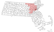
Cambridge ma highlight.png 788 × 466; 55 KB
-
Cambridge, MA Green Map.png 780 × 600; 709 KB
-
Fitchburg Cutoff modern status map.svg 1,850 × 1,150; 39 KB
-
Fitchburg Cutoff rail map.svg 1,850 × 1,150; 45 KB
-
FT WASH1.pdf 3,079 × 2,483; 287 KB
-
Longfellow National Historic Site, Massachusetts LOC 2005628441.jpg 7,038 × 5,055; 5.09 MB
-
Longfellow National Historic Site, Massachusetts LOC 2008624221.jpg 7,048 × 5,050; 5.35 MB
-
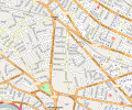
Oxford Street, Cambridge, Massachusetts.svg 1,041 × 868; 5.99 MB
-
Race and ethnicity 2020 Cambridge, MA.png 2,400 × 2,404; 5.77 MB
-
Scenes and approximate times of events of April 18-19.jpg 1,002 × 326; 556 KB


