Category:Maps of Cambria County, Pennsylvania
Jump to navigation
Jump to search
Counties of Pennsylvania : Adams · Allegheny · Armstrong · Beaver · Bedford · Berks · Blair · Bradford · Bucks · Butler · Cambria · Cameron · Carbon · Centre · Chester · Clarion · Clearfield · Clinton · Columbia · Crawford · Cumberland · Dauphin · Delaware · Elk · Erie · Fayette · Forest · Franklin · Fulton · Greene · Huntingdon · Indiana · Jefferson · Juniata · Lackawanna · Lancaster · Lawrence · Lebanon · Lehigh · Luzerne · Lycoming · McKean · Mercer · Mifflin · Monroe · Montgomery · Montour · Northampton · Northumberland · Perry · Philadelphia · Pike · Potter · Schuylkill · Snyder · Somerset · Sullivan · Susquehanna · Tioga · Union · Venango · Warren · Washington · Wayne · Westmoreland · Wyoming · York
Wikimedia category | |||||
| Upload media | |||||
| Instance of | |||||
|---|---|---|---|---|---|
| Category combines topics | |||||
| Cambria County | |||||
county in Pennsylvania, United States | |||||
| Instance of | |||||
| Named after |
| ||||
| Location | Pennsylvania | ||||
| Capital | |||||
| Inception |
| ||||
| Population |
| ||||
| Area |
| ||||
| official website | |||||
 | |||||
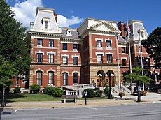
Cambria County is located in western Pennsylvania in the United States. Its county seat is Ebensburg.
Subcategories
This category has only the following subcategory.
.
Media in category "Maps of Cambria County, Pennsylvania"
The following 116 files are in this category, out of 116 total.
-
16640 area.png 575 × 425; 46 KB
-
Allegheny Portage Railroad.jpg 870 × 282; 61 KB
-
AltoonaNorthernMap.png 500 × 667; 13 KB
-
AltoonaNorthernMap.svg 400 × 600; 23 KB
-
Cambria and Indiana RR map 1923.png 910 × 617; 521 KB
-
Horseshoe Curve map, Horseshoe Curve Park PA (8911406185).jpg 4,610 × 3,321; 3.73 MB
-
Horseshoe Curve map.jpg 802 × 468; 81 KB
-
Map of Adams Township, Cambria County, Pennsylvania Highlighted.png 1,952 × 1,680; 65 KB
-
Map of Allegheny Township, Cambria County, Pennsylvania Highlighted.png 1,952 × 1,680; 65 KB
-
Map of Ashville, Cambria County, Pennsylvania Highlighted.png 1,952 × 1,680; 64 KB
-
Map of Barr Township, Cambria County, Pennsylvania Highlighted.png 1,952 × 1,680; 65 KB
-
Map of Beaverdale-Lloydell, Cambria County, Pennsylvania Highlighted.png 1,952 × 1,680; 65 KB
-
Map of Belmont, Cambria County, Pennsylvania Highlighted.png 1,952 × 1,680; 64 KB
-
Map of Blacklick Township, Cambria County, Pennsylvania Highlighted.png 1,952 × 1,680; 65 KB
-
Map of Brownstown, Cambria County, Pennsylvania Highlighted.png 1,952 × 1,680; 64 KB
-
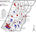
Map of Cambria County Pennsylvania School Districts.png 404 × 405; 19 KB
-
Map of Cambria County, Pennsylvania No Text.png 1,952 × 1,680; 69 KB
-
Map of Cambria County, Pennsylvania.png 1,952 × 1,680; 247 KB
-
Map of Cambria Township, Cambria County, Pennsylvania Highlighted.png 1,952 × 1,680; 65 KB
-
Map of Carroll Town, Cambria County, Pennsylvania Highlighted.png 1,952 × 1,680; 64 KB
-
Map of Cassandra, Cambria County, Pennsylvania Highlighted.png 1,952 × 1,680; 64 KB
-
Map of Chest Springs, Cambria County, Pennsylvania Highlighted.png 1,952 × 1,680; 64 KB
-
Map of Chest Township, Cambria County, Pennsylvania Highlighted.png 1,952 × 1,680; 65 KB
-
Map of Clearfield Township, Cambria County, Pennsylvania Highlighted.png 1,952 × 1,680; 65 KB
-
Map of Colver, Cambria County, Pennsylvania Highlighted.png 1,952 × 1,680; 65 KB
-
Map of Conemaugh Township, Cambria County, Pennsylvania Highlighted.png 1,952 × 1,680; 65 KB
-
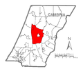
Map of Cresson Township, Cambria County, Pennsylvania Highlighted.png 1,952 × 1,680; 65 KB
-
Map of Cresson, Cambria County, Pennsylvania Highlighted.png 1,952 × 1,680; 64 KB
-
Map of Croyle Township, Cambria County, Pennsylvania Highlighted.png 1,952 × 1,680; 65 KB
-
Map of Daisytown, Cambria County, Pennsylvania Highlighted.png 1,952 × 1,680; 64 KB
-
Map of Dale, Cambria County, Pennsylvania Highlighted.png 1,952 × 1,680; 64 KB
-
Map of Dean Township, Cambria County, Pennsylvania Highlighted.png 1,952 × 1,680; 65 KB
-
Map of East Carroll Township, Cambria County, Pennsylvania Highlighted.png 1,952 × 1,680; 65 KB
-
Map of East Conemaugh, Cambria County, Pennsylvania Highlighted.png 1,952 × 1,680; 64 KB
-
Map of East Taylor Township, Cambria County, Pennsylvania Highlighted.png 1,952 × 1,680; 65 KB
-
Map of Ebensburg, Cambria County, Pennsylvania Highlighted.png 1,952 × 1,680; 64 KB
-
Map of Ehrenfeld, Cambria County, Pennsylvania Highlighted.png 1,952 × 1,680; 64 KB
-
Map of Elder Township, Cambria County, Pennsylvania Highlighted.png 1,952 × 1,680; 65 KB
-
Map of Elim, Cambria County, Pennsylvania Highlighted.png 1,952 × 1,680; 65 KB
-
Map of Ferndale, Cambria County, Pennsylvania Highlighted.png 1,952 × 1,680; 64 KB
-
Map of Franklin Township, Cambria County, Pennsylvania Highlighted.png 1,952 × 1,680; 64 KB
-
Map of Gallitzin Township, Cambria County, Pennsylvania Highlighted.png 1,952 × 1,680; 65 KB
-
Map of Gallitzin, Cambria County, Pennsylvania Highlighted.png 1,952 × 1,680; 64 KB
-
Map of Geistown, Cambria County, Pennsylvania Highlighted.png 1,952 × 1,680; 64 KB
-
Map of Hastings, Cambria County, Pennsylvania Highlighted.png 1,952 × 1,680; 64 KB
-
Map of Jackson Township, Cambria County, Pennsylvania Highlighted.png 1,952 × 1,680; 65 KB
-
Map of Johnstown, Cambria County, Pennsylvania Highlighted.png 1,952 × 1,680; 65 KB
-
Map of Lilly, Cambria County, Pennsylvania Highlighted.png 1,952 × 1,680; 64 KB
-
Map of Lorain, Cambria County, Pennsylvania Highlighted.png 1,952 × 1,680; 64 KB
-
Map of Loretto, Cambria County, Pennsylvania Highlighted.png 1,952 × 1,680; 64 KB
-
Map of Lower Yoder Township, Cambria County, Pennsylvania Highlighted.png 1,952 × 1,680; 65 KB
-
Map of Middle Taylor Township, Cambria County, Pennsylvania Highlighted.png 1,952 × 1,680; 65 KB
-
Map of Munster Township, Cambria County, Pennsylvania Highlighted.png 1,952 × 1,680; 65 KB
-
Map of Nanty-Glo, Cambria County, Pennsylvania Highlighted.png 1,952 × 1,680; 65 KB
-
Map of Northern Cambria, Cambria County, Pennsylvania Highlighted.png 1,952 × 1,680; 65 KB
-
Map of Patton, Cambria County, Pennsylvania Highlighted.png 1,952 × 1,680; 64 KB
-
Map of Pennsylvania highlighting Cambria County.svg 1,980 × 1,138; 96 KB
-
Map of Portage Township, Cambria County, Pennsylvania Highlighted.png 1,952 × 1,680; 65 KB
-
Map of Portage, Cambria County, Pennsylvania Highlighted.png 1,952 × 1,680; 64 KB
-
Map of Reade Township, Cambria County, Pennsylvania Highlighted.png 1,952 × 1,680; 65 KB
-
Map of Richland Township, Cambria County, Pennsylvania Highlighted.png 1,952 × 1,680; 65 KB
-
Map of Salix-Beauty Line Park, Cambria County, Pennsylvania Highlighted.png 1,952 × 1,680; 65 KB
-
Map of Sankertown, Cambria County, Pennsylvania Highlighted.png 1,952 × 1,680; 64 KB
-
Map of Scalp Level, Cambria County, Pennsylvania Highlighted.png 1,952 × 1,680; 64 KB
-
Map of South Fork, Cambria County, Pennsylvania Highlighted.png 1,952 × 1,680; 64 KB
-
Map of Southmont, Cambria County, Pennsylvania Highlighted.png 1,952 × 1,680; 64 KB
-
Map of Spring Hill, Cambria County, Pennsylvania Highlighted.png 1,952 × 1,680; 65 KB
-
Map of St. Michael-Sidman, Cambria County, Pennsylvania Highlighted.png 1,952 × 1,680; 65 KB
-
Map of Stonycreek Township, Cambria County, Pennsylvania Highlighted.png 1,952 × 1,680; 65 KB
-
Map of Summerhill Township, Cambria County, Pennsylvania Highlighted.png 1,952 × 1,680; 65 KB
-
Map of Summerhill, Cambria County, Pennsylvania Highlighted.png 1,952 × 1,680; 64 KB
-
Map of Susquehanna Township, Cambria County, Pennsylvania Highlighted.png 1,952 × 1,680; 65 KB
-
Map of Upper Yoder Township, Cambria County, Pennsylvania Highlighted.png 1,952 × 1,680; 65 KB
-
Map of Vinco, Cambria County, Pennsylvania Highlighted.png 1,952 × 1,680; 65 KB
-
Map of Vintondale, Cambria County, Pennsylvania Highlighted.png 1,952 × 1,680; 64 KB
-
Map of Washington Township, Cambria County, Pennsylvania Highlighted.png 1,952 × 1,680; 65 KB
-
Map of West Carroll Township, Cambria County, Pennsylvania Highlighted.png 1,952 × 1,680; 65 KB
-
Map of West Taylor Township, Cambria County, Pennsylvania Highlighted.png 1,952 × 1,680; 65 KB
-
Map of Westmont, Cambria County, Pennsylvania Highlighted.png 1,952 × 1,680; 65 KB
-
Map of White Township, Cambria County, Pennsylvania Highlighted.png 1,952 × 1,680; 65 KB
-
Map of Wilmore, Cambria County, Pennsylvania Highlighted.png 1,952 × 1,680; 64 KB
-
Plan of Beula Pennsylvania.png 398 × 512; 144 KB
