Category:Maps of Bundesautobahn 8
Jump to navigation
Jump to search
Wikimedia category | |||||
| Upload media | |||||
| Instance of | |||||
|---|---|---|---|---|---|
| Category combines topics | |||||
| Bundesautobahn 8 | |||||
federal motorway in Germany | |||||
| Instance of | |||||
| Part of | |||||
| Location | |||||
| Transport network | |||||
| Owned by | |||||
| Maintained by | |||||
| Length |
| ||||
 | |||||
Media in category "Maps of Bundesautobahn 8"
The following 18 files are in this category, out of 18 total.
-
Bundesautobahn 8 map.png 1,122 × 1,515; 80 KB
-
Map D A8.svg 1,073 × 1,272; 467 KB
-
Echterdinger Ei.png 1,520 × 1,102; 645 KB
-
Behelfsanschluss Hohenstadt an der Bundesautobahn 8.png 1,520 × 1,137; 244 KB
-
AD Inntal.png 550 × 435; 72 KB
-
AD Karlsruhe map.png 817 × 612; 619 KB
-
Autobahndreieck Karlsruhe der A8 mit der A5.png 1,520 × 1,136; 674 KB
-
Autobahndreieck-Leonberg.svg 1,568 × 1,300; 3.87 MB
-
Autobahnkreuz München-Süd.svg 2,204 × 2,799; 492 KB
-
AK-Muenchen-West.png 1,553 × 1,067; 192 KB
-
Dreieck Pirmasens.png 1,938 × 618; 55 KB
-
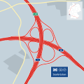
AK Saarbrücken map.png 818 × 614; 554 KB
-
Interchange Germany - Autobahnkreuz Saarbrücken.svg 1,700 × 1,700; 87 KB
-
Autobahnen um Stuttgart Planung Durchführung.png 5,648 × 2,829; 562 KB
-
Autobahnkreuz Stuttgart der A81 mit der A831 und der A8.png 1,476 × 1,071; 847 KB
-
Anschlussstelle Ulm-Ost an der A8.png 1,520 × 1,137; 267 KB
-
Anschlussstelle Ulm West an der A8.png 1,521 × 1,135; 372 KB
-
Autobahnkreuz Ulm Elchingen der A8 und der A7.png 1,520 × 1,136; 337 KB


