Category:Maps of Brocken
Jump to navigation
Jump to search
Subcategories
This category has only the following subcategory.
Media in category "Maps of Brocken"
The following 17 files are in this category, out of 17 total.
-
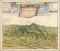
1732 illustration of Blocksberg.jpg 14,017 × 12,060; 25.49 MB
-
Bomsdorff's neueste special Karte vom Harz - Kopie (3).jpg 1,977 × 1,994; 1.46 MB
-
Brocken aus Meyers Reisebücher.png 2,249 × 1,697; 7.76 MB
-
Brocken L. S. Bestehorn cropped.jpg 797 × 416; 446 KB
-
Brocken L. S. Bestehorn.jpg 1,770 × 1,517; 2.88 MB
-
Brocken Panorama-Postkarte 1.jpg 3,287 × 2,163; 929 KB
-
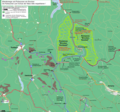
Brocken wanderwege und ruhezonen ds wv 12 2011.png 1,899 × 1,770; 1.56 MB
-
Brocken, perspektivische Ansicht.jpg 800 × 600; 175 KB
-
Brockenkarte C. E. Nehse.jpg 1,483 × 2,433; 752 KB
-
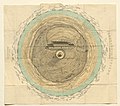
Brockenkuppe wp.png 1,831 × 1,280; 320 KB
-
Höhenschichten Karte des Harzgebirges, Kartenausschnitt Brocken.jpg 1,785 × 1,567; 1.89 MB
-
Nationalpark Hochharz, Brocken Gipfel, Oct 1995 (4256971663).jpg 3,599 × 2,399; 439 KB
-
Panorama vom Brocken.jpg 3,906 × 4,288; 6.01 MB
-
Panorama vom Brocken.png 5,292 × 5,888; 53.6 MB
-
Panorama-vom-brocken-60588.jpg 4,497 × 3,983; 4.27 MB
-
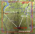
Reliefenergie- Flächenbezug.jpg 510 × 497; 452 KB


