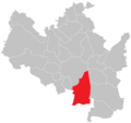
Category:Maps of Brno-South
Jump to navigation
Jump to search
Subcategories
This category has the following 5 subcategories, out of 5 total.
D
- Maps of Dolní Heršpice (2 F)
H
- Maps of Horní Heršpice (2 F)
K
- Maps of Komárov (Brno) (5 F)
P
- Maps of Přízřenice (2 F)
T
- Maps of Trnitá (10 F)
Media in category "Maps of Brno-South"
The following 4 files are in this category, out of 4 total.
-
Blank map of City districts of Brno - South.svg 1,162 × 901; 462 KB
-
Brno MČ Brno-jih.png 887 × 835; 37 KB
-
Location of Brno-jih.svg 493 × 460; 43 KB
-
Silnice I-41.png 475 × 619; 162 KB


