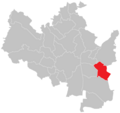
Category:Maps of Brno-Slatina
Jump to navigation
Jump to search
Media in category "Maps of Brno-Slatina"
The following 8 files are in this category, out of 8 total.
-
Blank map of City districts of Brno - Slatina.svg 1,162 × 901; 462 KB
-
Brno KÚ Slatina.png 887 × 835; 41 KB
-
Brno MČ Brno-Slatina.png 887 × 835; 37 KB
-
Brno, Slatina, stabilní katastr.jpg 1,843 × 1,225; 814 KB
-
Brno, Slatinka, stabilní katastr.jpg 1,245 × 862; 253 KB
-
Cernovicka terasa.jpg 1,280 × 958; 1.24 MB
-
LKTB 02.jpg 2,200 × 1,301; 341 KB
-
Location of Brno-Slatina.svg 493 × 460; 40 KB


