Category:Maps of British Burma
Jump to navigation
Jump to search
Media in category "Maps of British Burma"
The following 29 files are in this category, out of 29 total.
-
 Volker-Karte der Indischen Welt 1847.jpg 2,954 × 2,420; 2.22 MB
-

-

-
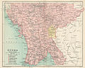
 Arakan Division 1931.png 516 × 948; 120 KB
-
 British India-es.svg 512 × 394; 849 KB
-
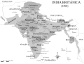
 British India.png 1,600 × 1,235; 680 KB
-
 British Raj-es.svg 1,201 × 1,007; 176 KB
-
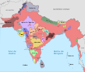
 British Raj.svg 1,201 × 1,007; 221 KB
-
 Burma indo china 1886.jpg 550 × 1,100; 183 KB
-
 Burma Northern section.jpg 1,000 × 814; 331 KB
-
 Burma Province 1931 UNLABELLED.png 4,991 × 9,536; 834 KB
-
 Burma Province 1931.png 1,548 × 2,953; 809 KB
-
 BurmaMap1922.png 2,105 × 3,072; 2.62 MB
-
 Colonial Boundaries in Southeast Asia.jpg 1,229 × 898; 220 KB
-
 Free homes in Manitoba and the Canadian North-West (microform) (1886) (20631623951).jpg 3,298 × 1,904; 1.14 MB
-
 Hindoostan map 1814.jpg 2,489 × 2,430; 5.97 MB
-
 India (1899).jpg 3,382 × 3,429; 5.16 MB
-
 India 1819-1909.svg 1,200 × 1,000; 790 KB
-
 IndianEmpireCeylon1915.jpg 1,200 × 1,098; 268 KB
-
 IndiaPolitical1893ConstablesHandAtlas.jpg 1,318 × 1,027; 341 KB
-
 Joppen1907BritishBengalBritishBurmaA.jpg 877 × 1,200; 238 KB
-
 Key to Section maps, plates 22 to 36, of the Indian Empire.jpg 1,398 × 1,072; 435 KB
-
-

-
 Political Divisions of the Indian Empire, 1909.jpg 734 × 599; 165 KB
-
 Railroads in Burma.jpg 542 × 1,222; 461 KB
-

-

-
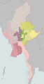
 영국령 버마.png 1,045 × 891; 123 KB


.jpg)


_(1886)_(20631623951).jpg)

.jpg)


_from_The_Imperial_Gazetteer_of_India_(1907-1909).jpg)
.jpg)


.jpg)
