Category:Maps of Bridgeport, Connecticut
Jump to navigation
Jump to search
Wikimedia category | |||||
| Upload media | |||||
| Instance of | |||||
|---|---|---|---|---|---|
| Category combines topics | |||||
| Bridgeport | |||||
county seat city of Fairfield County, Connecticut, United States | |||||
| Instance of |
| ||||
| Location | Fairfield County, Connecticut | ||||
| Located in or next to body of water | |||||
| Head of government | |||||
| Inception |
| ||||
| Population |
| ||||
| Area |
| ||||
| Elevation above sea level |
| ||||
| official website | |||||
 | |||||
Subcategories
This category has the following 2 subcategories, out of 2 total.
Media in category "Maps of Bridgeport, Connecticut"
The following 30 files are in this category, out of 30 total.
-
Bridgeport 1824.png 3,450 × 2,762; 6.04 MB
-
Bridgeport CT lg.PNG 1,824 × 1,374; 109 KB
-
Bridgeport neighborhood map - Black Rock.png 1,896 × 2,374; 752 KB
-
Bridgeport neighborhood map - Boston Ave - Mill Hill.png 1,896 × 2,374; 763 KB
-
Bridgeport neighborhood map - Brooklawn - St Vincent.png 1,896 × 2,374; 751 KB
-
Bridgeport neighborhood map - Downtown.png 1,896 × 2,374; 762 KB
-
Bridgeport neighborhood map - East End.png 1,896 × 2,374; 757 KB
-
Bridgeport neighborhood map - East Side.png 1,896 × 2,374; 760 KB
-
Bridgeport neighborhood map - Enterprise Zone.png 1,896 × 2,374; 765 KB
-
Bridgeport neighborhood map - Hollow.png 1,896 × 2,374; 764 KB
-
Bridgeport neighborhood map - North Bridgeport.png 1,896 × 2,374; 757 KB
-
Bridgeport neighborhood map - North End.png 1,896 × 2,374; 741 KB
-
Bridgeport neighborhood map - Reservoir - Whiskey Hill.png 1,896 × 2,374; 758 KB
-
Bridgeport neighborhood map - South End.png 1,896 × 2,374; 759 KB
-
Bridgeport neighborhood map - West End - West Side.png 1,896 × 2,374; 755 KB
-
Bridgeport neighborhood map with labels.png 1,896 × 2,374; 823 KB
-
Bridgeport neighborhood map.png 1,896 × 2,374; 768 KB
-
Bridgeport, Conn., 1882. From 'old mill hill' (updated) LCCN2004666877.jpg 9,925 × 5,912; 7.17 MB
-
City of Bridgeport, Fairfield County, Connecticut LOC 2017591006.jpg 4,822 × 6,595; 5.72 MB
-
Little Liberia (Bridgeport, Connecticut) 1850.png 1,167 × 1,265; 926 KB
-
Map of Bridgeport, 1824.jpg 2,370 × 1,918; 367 KB
-
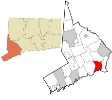
Map of Connecticut highlighting Greater Bridgeport Region.PNG 450 × 336; 102 KB
-
Map of Fairfield County, Connecticut Bridgeport Highlighted.PNG 323 × 429; 9 KB
-
Map of the city of Bridgeport, Conn. LOC gm71003380.jpg 11,110 × 11,468; 15 MB
-
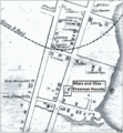
Mary and Eliza Freeman Houses map 1850.png 1,167 × 1,265; 917 KB
-
Old Stratfield (Bridgeport) Map before 1886.jpg 1,851 × 2,267; 325 KB
-
US-CT-Bridgeport.png 450 × 336; 54 KB
-
View of Bridgeport, Ct. 1875. LOC 74693240.jpg 11,264 × 8,368; 18.91 MB


