Category:Maps of Bourg-en-Bresse
Jump to navigation
Jump to search
Wikimedia category | |||||
| Upload media | |||||
| Instance of | |||||
|---|---|---|---|---|---|
| Category combines topics | |||||
| Bourg-en-Bresse | |||||
commune in Ain, France | |||||
| Pronunciation audio | |||||
| Instance of | |||||
| Named after | |||||
| Location |
| ||||
| Located in or next to body of water | |||||
| Official language | |||||
| Head of government |
| ||||
| Inception |
| ||||
| Significant event |
| ||||
| Population |
| ||||
| Area |
| ||||
| Elevation above sea level |
| ||||
| official website | |||||
 | |||||
Subcategories
This category has the following 2 subcategories, out of 2 total.
M
- Maps of Réseau Rubis (17 F)
Media in category "Maps of Bourg-en-Bresse"
The following 31 files are in this category, out of 31 total.
-
01 AIN carte grille communale densite INSEE.png 3,507 × 2,480; 3.43 MB
-
01-AAV2020-Bourg-en-Bresse.png 3,519 × 2,930; 2.41 MB
-
01-Bourg-en-Bresse-AAV2020.png 3,519 × 2,930; 2.62 MB
-
01053 in dept 01.svg 1,000 × 908; 149 KB
-
01053-Bourg-en-Bresse-Hydro.png 3,507 × 2,480; 5.58 MB
-
01053-Bourg-en-Bresse-Sols.png 3,270 × 2,598; 5.61 MB
-
Arrondissement de Bourg-en-Bresse.PNG 503 × 482; 19 KB
-
Bourg-en-Bresse (Ain) dans son Arrondissement.png 2,000 × 1,816; 521 KB
-
Bourg-en-Bresse (Axes communication).svg 1,254 × 1,111; 1.2 MB
-
Bourg-en-Bresse Carte.svg 1,015 × 965; 1.26 MB
-
Bourg-en-Bresse location map.png 2,024 × 1,933; 5.44 MB
-
Bourg-en-Bresse OSM 01.png 551 × 537; 217 KB
-
Bourg-en-Bresse OSM 02.png 551 × 537; 366 KB
-
Bourgogne, Bresse, Bourg-en-Bresse, Brou 16-1.jpg 3,215 × 2,307; 1.92 MB
-
Canton Bourg-en-Bresse-1.svg 1,300 × 1,600; 41 KB
-
Canton Bourg-en-Bresse-2.svg 1,300 × 1,600; 43 KB
-
Carte du cimetière de Bourg-en-Bresse.jpg 980 × 707; 733 KB
-
Carte Rocade Bourg Bresse.svg 890 × 720; 55 KB
-
Grondplan - Koninklijk klooster van Brou 25-10-2016 9-59-53.JPG 2,325 × 1,934; 2.29 MB
-
Géolocalisation Bourg-en-Bresse.jpg 513 × 454; 82 KB
-
Géolocalisation Monastère royal de Brou.jpg 624 × 663; 65 KB
-
Limite Cantons Bourg-en-Bresse.svg 1,050 × 1,050; 20 KB
-
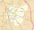
Map commune FR insee code 01053.png 756 × 605; 62 KB
-
Plan Bourg Bresse Forêt.svg 1,100 × 1,100; 57 KB
-
Plan Bourg Bresse.svg 1,000 × 1,000; 128 KB
-
Plan Citadelle de Bourg 1876.jpg 9,216 × 6,908; 20.32 MB
-
Plan Cocathédrale Notre-Dame Bourg Bresse 1.jpg 3,024 × 4,032; 2.64 MB
-
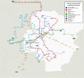
Réseau TUB Bourg Bresse Routes.svg 1,738 × 1,605; 2.69 MB
-
Réseau TUB Bourg Bresse.svg 1,738 × 1,605; 2.01 MB
-
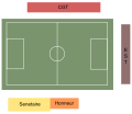
Stade Verchère.svg 750 × 650; 24 KB


