Category:Maps of Bosporan Kingdom
Jump to navigation
Jump to search
Wikimedia category | |||||
| Upload media | |||||
| Instance of | |||||
|---|---|---|---|---|---|
| Category combines topics | |||||
| Bosporan Kingdom | |||||
Greco-Scythian state near Sea of Azov (c.438 BC–c.527 AD) | |||||
| Instance of |
| ||||
| Location |
| ||||
| Capital | |||||
| Basic form of government | |||||
| Inception |
| ||||
| Dissolved, abolished or demolished date |
| ||||
| Religion or worldview | |||||
| Follows |
| ||||
| Followed by |
| ||||
| Different from | |||||
 | |||||
Subcategories
This category has only the following subcategory.
M
Media in category "Maps of Bosporan Kingdom"
The following 19 files are in this category, out of 19 total.
-
218BCMAPMEDITERRANEAN.jpg 1,216 × 720; 89 KB
-
Baspor Kimer.png 1,488 × 1,096; 200 KB
-
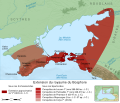
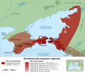
Bosporan Kingdom growth map-en.svg 675 × 575; 752 KB
-
Bosporan Kingdom growth map-es.svg 675 × 575; 2.21 MB
-
Bosporan Kingdom growth map-fr.svg 675 × 575; 1.13 MB
-
Bosporan Kingdom growth map-pt.svg 675 × 575; 752 KB
-
Bosporan Kingdom growth map-ru.svg 675 × 575; 1.39 MB
-
Bosporan Kingdom growth map-uk.svg 675 × 575; 729 KB
-
Bosporus and Pontus MAP.png 768 × 576; 88 KB
-
Crimea 2nd century BC map-es.svg 1,070 × 843; 508 KB
-
Crimea 2nd century BC map.png 430 × 335; 30 KB
-
Pontos Euxeinos.gif 670 × 488; 56 KB
-
Roman Empire 125 (cropped).png 487 × 308; 171 KB
-
Tanais Museum 22.jpg 3,261 × 2,540; 4.27 MB
-
Tanais Museum 44.jpg 3,181 × 1,877; 3.26 MB
-
Towns Bosporan Kingdom hu.svg 425 × 349; 75 KB
-
Towns Bosporan Kingdom.png 425 × 349; 22 KB
-
БоспорIV-II.png 800 × 580; 406 KB
-
Музей Горгиппия. Экспонат. (47).jpg 3,344 × 2,322; 4.45 MB


