Category:Maps of Blois
Jump to navigation
Jump to search
Wikimedia category | |||||
| Upload media | |||||
| Instance of | |||||
|---|---|---|---|---|---|
| Category combines topics | |||||
| Blois | |||||
French commune and city in Loir-et-Cher, Centre-Val de Loire | |||||
| Instance of | |||||
| Location |
| ||||
| Located in or next to body of water | |||||
| Head of government |
| ||||
| Population |
| ||||
| Area |
| ||||
| Elevation above sea level |
| ||||
| official website | |||||
 | |||||
Subcategories
This category has the following 4 subcategories, out of 4 total.
Media in category "Maps of Blois"
The following 15 files are in this category, out of 15 total.
-
41018-Blois-géologie.png 7,015 × 4,960; 3.8 MB
-
Arrou.png 883 × 234; 272 KB
-
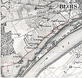
Blois (France) - rue Albert 1er carte d'état-major 1846.jpg 3,331 × 3,168; 1.47 MB
-
Blois OSM 01.png 690 × 628; 471 KB
-
Blois OSM 02.png 690 × 628; 847 KB
-
Diocèse Blois 1789.svg 2,000 × 1,922; 801 KB
-
Foret de blois (carte).png 1,653 × 2,339; 228 KB
-
Fromer bridges of Blois.svg 1,600 × 692; 3.4 MB
-
Fromer bridges on the Cosson in Blois.svg 1,317 × 897; 1.72 MB
-
Localisation de Cheverny.jpg 562 × 462; 20 KB
-
Lots de chasse en forêt de Blois (ONF, 2009).png 706 × 997; 202 KB
-
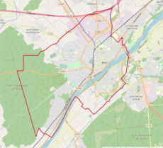
Map commune FR insee code 41018.png 756 × 605; 81 KB
-
Plan Blois OSM zoom 13.jpg 910 × 826; 204 KB
-
Vandalisme cyclosm 19-06-2024.png 988 × 754; 1.27 MB
-
Vue satellite des anciens ponts de Blois.png 1,552 × 535; 1.82 MB


