Category:Maps of Bharatiya Janata Party
Jump to navigation
Jump to search
Subcategories
This category has only the following subcategory.
Media in category "Maps of Bharatiya Janata Party"
The following 17 files are in this category, out of 17 total.
-
2014 general elections Kerala NDA seat sharing.png 349 × 599; 52 KB
-
Bhajapa+ 2021.png 1,088 × 1,308; 469 KB
-
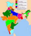
Bharatiya Janata Party in states.png 1,594 × 1,868; 212 KB
-
BJP CM.png 3,818 × 4,600; 1.1 MB
-
BJP presence by state (till 2023).svg 1,700 × 1,994; 199 KB
-
BJP presence by states & union territories.svg 1,700 × 1,994; 198 KB
-
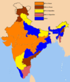
BJP Sates 2009.png 510 × 593; 85 KB
-
BJP West Bengal Seat Sharing 2021.svg 1,091 × 1,310; 6.04 MB
-
Inde GouvÉtats BJP.svg 512 × 600; 399 KB
-
Indian states 2014 December NDA.png 1,486 × 1,734; 207 KB
-
Indian states 2014 NDA.png 1,486 × 1,734; 321 KB
-
Indian states by bjp.png 1,486 × 1,734; 273 KB
-
Indian states NDA.png 1,486 × 1,734; 272 KB
-
Indian States ruled by National Democratic Alliance led by BJP.png 1,486 × 1,734; 273 KB
-
Presence of BJP in various states.jpg 1,080 × 1,218; 234 KB
-
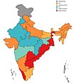
Ruling Parties in States and UT's of India as of December 2019.jpg 1,080 × 1,213; 237 KB
-
Tripura NDA Seat Share.jpg 600 × 730; 68 KB


